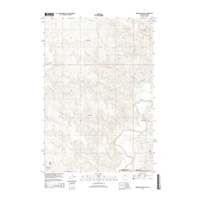
2014 Map of Bradshaw Creek
USGS Topo · Published 2014About this map
The Powder River meanders through this borderland where Campbell County, Wyoming meets Montana, defining a landscape of deep draws and sharp ridges. Notable elevations like Black Eagle Butte and the Spear Hills overlook a network of seasonal drainages, including Bradshaw Cr and Rough Cr. The topography is marked by significant erosion patterns, visible in features such as Kroger Draw and Black Draw. Transportation in this sparsely populated ranching country is limited to primary corridors like Highline Rd and Moorehead Rd, which follow the natural contours of the high plains. This 2014 survey documents the complex land divisions of the Public Land Survey System, including T8S R47E and T9S R48E, providing a detailed record of the physical and administrative boundaries of the northern Powder River Basin.
Find a feature on this map
22 named features on this map. Tap any name to fly to it.
Don’t see what you’re looking for? This feature index may not catch every label — zoom into the map to look around manually.
Map Details
Editions of this 2014 Bradshaw Creek Map
This is the sole edition of this map. No revisions or reprints were ever made.
Other maps of this area

1954 · Hardin
USGS Topo · 1:250,000

1954 · Ekalaka
USGS Topo · 1:250,000

1954 · Gillette
USGS Topo · 1:250,000

1955 · Sheridan
USGS Topo · 1:250,000

1955 · Gillette
USGS Topo · 1:250,000

1956 · Ekalaka
USGS Topo · 1:250,000

1957 · Hardin
USGS Topo · 1:250,000

1958 · Gillette
USGS Topo · 1:250,000

1958 · Ekalaka
USGS Topo · 1:250,000

1958 · Hardin
USGS Topo · 1:250,000