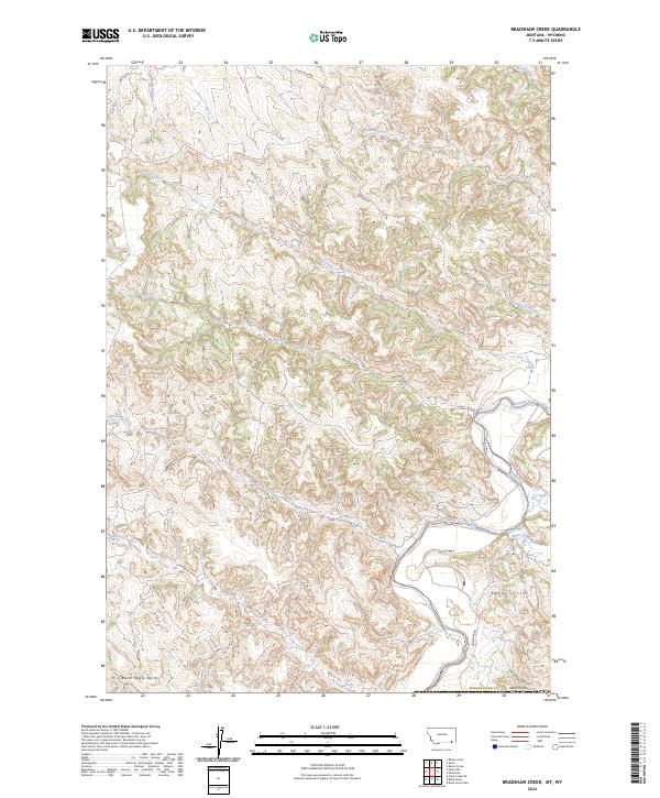
2024 Map of Bradshaw Creek
USGS Topo · Published 2024About this map
The Powder River carves a winding path through the southeastern corner of this corner of Montana, defining a landscape shaped by intricate drainage networks. Named watercourses such as Bradshaw Creek, Bitter Creek, and Thompson Creek create a deeply dissected terrain that feeds into the main river valley. Notable landmarks like the Spear Hills and the prominent Black Eagle Butte rise above the surrounding drainages, offering distinct navigational points in an area largely characterized by its geological relief. The network of local roads, including Moorhead Rd and Highline Rd, follows the natural contours of the land and the river's course, reflecting the rural ranching and land-management patterns of Powder River Co as documented by the U.S. Geological Survey. This 2024 data provides a clear record of the modern hydrography and public land divisions within the northern reaches of the Powder River basin.
Find a feature on this map
22 named features on this map. Tap any name to fly to it.
Don’t see what you’re looking for? This feature index may not catch every label — zoom into the map to look around manually.
Map Details
Editions of this 2024 Bradshaw Creek Map
This is the sole edition of this map. No revisions or reprints were ever made.
Other maps of this area

1954 · Hardin
USGS Topo · 1:250,000

1954 · Ekalaka
USGS Topo · 1:250,000

1954 · Gillette
USGS Topo · 1:250,000

1955 · Sheridan
USGS Topo · 1:250,000

1955 · Gillette
USGS Topo · 1:250,000

1956 · Ekalaka
USGS Topo · 1:250,000

1957 · Hardin
USGS Topo · 1:250,000

1958 · Gillette
USGS Topo · 1:250,000

1958 · Ekalaka
USGS Topo · 1:250,000

1958 · Hardin
USGS Topo · 1:250,000