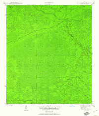
1945 Map of Bradwell Bay
USGS Topo · Published 1960About this map
Bradwell Bay dominates this mid-1940s landscape, a dense swampy interior within the larger Apalachicola National Forest. The map, produced through the joint efforts of the War Department Corps of Engineers and the Geological Survey, captures the primitive hydrological network of Wakulla County during the war years. The Sopchoppy River meanders through the northern and eastern sections of the quadrangle, joined by smaller tributaries like Monkey Creek. This survey highlights a wilderness area before significant modern drainage or development, focusing on the natural topography and the sparse forest road network that served the region's timber and conservation interests. It provides a foundational record of the Florida panhandle's inland wetlands during a period of transition for the National Forest system.
Find a feature on this map
5 named features on this map. Tap any name to fly to it.
Don’t see what you’re looking for? This feature index may not catch every label — zoom into the map to look around manually.
Map Details
Editions of this 1945 Bradwell Bay Map
4 editions found
Other maps of this area

1940 · Tallahassee
USGS Topo · 1:62,500

1940 · Arran
USGS Topo · 1:62,500

1942 · Tallahassee
USGS Topo · 1:62,500

1943 · Arran
USGS Topo · 1:62,500

1943 · Tallahassee
USGS Topo · 1:62,500

1943 · Lake Talquin
USGS Topo · 1:62,500

1945 · Thousand Yard Bay
USGS Topo · 1:31,680

1945 · Smith Creek
USGS Topo · 1:31,680

1945 · Bradwell Bay
USGS Topo · 1:31,680

1945 · Sanborn
USGS Topo · 1:31,680