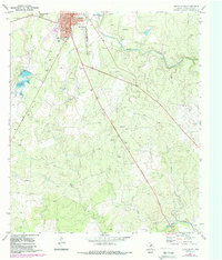
1970 Map of Brady South
USGS Topo · Published 1988About this map
Brady serves as the focal point of this Central Texas landscape, where urban expansion is noted in the northern reaches near Stanburn Park and the local Hospital. The survey illustrates a transition from the structured street grid of the town to a terrain heavily utilized for resources, evidenced by the numerous Gravel Pit and Gravel Pits sites scattered throughout the countryside. A notable local landmark, the G Rollie White Downs Racetrack, sits just northwest of the town center, reflecting the regional importance of this McCulloch County hub in the 1970s and 1980s.
Find a feature on this map
22 named features on this map. Tap any name to fly to it.
Don’t see what you’re looking for? This feature index may not catch every label — zoom into the map to look around manually.
Map Details
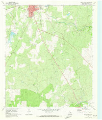
Editions of this 1970 Brady South Map
2 editions found
Other maps of this area

1887 · Mason
USGS Topo · 1:125,000

1894 · Brady
USGS Topo · 1:125,000

1894 · Mason
USGS Topo · 1:125,000

1954 · Brownwood
USGS Topo · 1:250,000

1954 · Llano
USGS Topo · 1:250,000

1955 · Llano
USGS Topo · 1:250,000

1956 · Llano
USGS Topo · 1:250,000

1960 · West Sweden
USGS Topo · 1:24,000

1960 · Brady North
USGS Topo · 1:24,000

1963 · Spy Rock
USGS Topo · 1:24,000