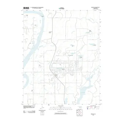
2010 Map of Braggs
USGS Topo · Published 2010About this map
Camp Gruber dominates the central and eastern sections of this landscape, its military infrastructure and road network established north of the settlement of Braggs. This area of Muskogee County is defined by the winding course of the Arkansas River to the west, which creates a prominent peninsula at Gooseneck Bend. The terrain transitions from the low-lying river bottomlands to the elevation of Devils Peak, with several small creeks like Bondinot Creek and Joe Branch draining the upland areas toward the river.
Find a feature on this map
49 named features on this map. Tap any name to fly to it.
Don’t see what you’re looking for? This feature index may not catch every label — zoom into the map to look around manually.
Map Details
Editions of this 2010 Braggs Map
This is the sole edition of this map. No revisions or reprints were ever made.
Other maps of this area

1901 · Muscogee
USGS Topo · 1:125,000

1905 · Muscogee
USGS Topo · 1:125,000

1946 · Fort Smith
USGS Topo · 1:250,000

1948 · Hulbert
USGS Topo · 1:62,500

1948 · Keefeton
USGS Topo · 1:62,500

1948 · Webbers Falls
USGS Topo · 1:62,500

1948 · Wagoner
USGS Topo · 1:62,500

1950 · Keefeton
USGS Topo · 1:62,500

1950 · Wagoner
USGS Topo · 1:62,500

1950 · Hulbert
USGS Topo · 1:62,500