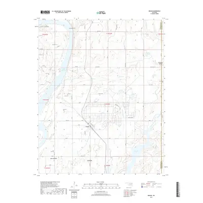
2018 Map of Braggs
USGS Topo · Published 2018About this map
Braggs sits as a central hub in this Muskogee County landscape, where the town’s grid meets a complex network of reservoirs and creeks. To the west, the Arkansas River’s influence is seen through the Webbers Falls Reservoir and the sharp relief of Devils Peak near Gooseneck Bend. The map details several smaller water management features, such as 101021 Reservoir and WPA Pond, which point to the managed hydrology of the late 20th and early 21st centuries. Local genealogy is well-supported by several family-named and community burial grounds, including Harnage Cem, Harris Cem, and South Bethel Cem. In the east, the terrain rises toward Fire Tower Hill and falls into the basin of Greenleaf Lake, while the presence of locations like Central Europe and Pumpkin Center reflects the area's rural settlement patterns and local place-naming traditions.
Find a feature on this map
58 named features on this map. Tap any name to fly to it.
Don’t see what you’re looking for? This feature index may not catch every label — zoom into the map to look around manually.
Map Details
Editions of this 2018 Braggs Map
This is the sole edition of this map. No revisions or reprints were ever made.
Other maps of this area

1901 · Muscogee
USGS Topo · 1:125,000

1905 · Muscogee
USGS Topo · 1:125,000

1946 · Fort Smith
USGS Topo · 1:250,000

1948 · Hulbert
USGS Topo · 1:62,500

1948 · Keefeton
USGS Topo · 1:62,500

1948 · Webbers Falls
USGS Topo · 1:62,500

1948 · Wagoner
USGS Topo · 1:62,500

1950 · Keefeton
USGS Topo · 1:62,500

1950 · Wagoner
USGS Topo · 1:62,500

1950 · Hulbert
USGS Topo · 1:62,500