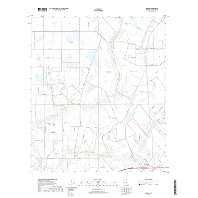
2018 Map of Branch
USGS Topo · Published 2018About this map
Branch and the northern reaches of Rayne define this portion of Acadia Parish, where the Louisiana prairie is divided by a complex network of drainage coulees and bayous. The landscape is characterized by the meandering paths of Bayou Wikoff and the Coulee Duralde, which cut through the agricultural grid. For genealogists, the map is particularly rich in family-named sites, featuring numerous small burial grounds such as Hebert Cem, Murphy Cem, and Arceneaux Cem. These sites, often situated near watercourses like Gumpoint Gully or Bideman Gully, provide a detailed record of local family landholdings and early settlement patterns. The road network, including Thevis Rd and Prairie Hayes Rd, follows the section lines of the Public Land Survey System, illustrating the orderly transition from historical land grants to modern rural infrastructure.
Find a feature on this map
76 named features on this map. Tap any name to fly to it.
Don’t see what you’re looking for? This feature index may not catch every label — zoom into the map to look around manually.
Map Details
Editions of this 2018 Branch Map
This is the sole edition of this map. No revisions or reprints were ever made.
Other maps of this area

1934 · Duson
USGS Topo · 1:31,680

1935 · Branch
USGS Topo · 1:31,680

1946 · Rayne
USGS Topo · 1:31,680

1947 · Branch
USGS Topo · 1:31,680

1947 · Eunice
USGS Topo · 1:31,680

1947 · Iota
USGS Topo · 1:31,680

1947 · Pitreville
USGS Topo · 1:31,680

1949 · Estherwood
USGS Topo · 1:31,680

1952 · Lake Charles
USGS Topo · 1:250,000

1954 · Duson
USGS Topo · 1:31,680