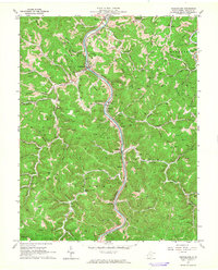
1962 Map of Branchland
USGS Topo · Published 1964About this map
The Guyandotte River serves as the primary artery through this Lincoln County landscape, dictating the placement of both the Chesapeake and Ohio railroad and primary settlements. Communities such as Branchland, Midkiff, and Sheridan are pinned between the river and the steep ridges of Laurel Hill. The extraction of natural resources is evident throughout the terrain, with numerous gas and oil wells dotting the hillsides, supported by a Compressor Sta near Hubball.
Find a feature on this map
94 named features on this map. Tap any name to fly to it.
Don’t see what you’re looking for? This feature index may not catch every label — zoom into the map to look around manually.
Map Details
Editions of this 1962 Branchland Map
3 editions found
Other maps of this area

1892 · Huntington
USGS Topo · 1:125,000

1898 · Huntington
USGS Topo · 1:125,000

1901 · Guyandot
USGS Topo · 1:62,500

1902 · Guyandot
USGS Topo · 1:62,500

1902 · Milton
USGS Topo · 1:62,500

1902 · Midkiff
USGS Topo · 1:62,500

1907 · Midkiff
USGS Topo · 1:62,500

1909 · Wayne
USGS Topo · 1:62,500

1909 · Midkiff
USGS Topo · 1:62,500

1931 · Wayne
USGS Topo · 1:62,500