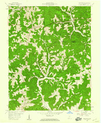
1958 Map of Branchville
USGS Topo · Published 1959About this map
The Hoosier National Forest dominates this section of southern Indiana, where the rugged topography of McKenzie Ridge and Doan Ridge is dissected by a dense network of hollows and creeks. Small settlements like Saint Croix, Branchville, and Celina serve as anchors in a landscape defined by narrow valley floors and timbered uplands. The mapping reveals a distinct pattern of small-scale rural development, with numerous family burial grounds such as Rickenbaugh Cem and Woolums Cem tucked into the hillsides near drainage systems like Oil Creek.
Find a feature on this map
54 named features on this map. Tap any name to fly to it.
Don’t see what you’re looking for? This feature index may not catch every label — zoom into the map to look around manually.
Map Details
Editions of this 1958 Branchville Map
4 editions found
Other maps of this area

1950 · Beechwood
USGS Topo · 1:24,000

1950 · English
USGS Topo · 1:24,000

1950 · Alton
USGS Topo · 1:62,500

1950 · Alton
USGS Topo · 1:24,000

1951 · Alton
USGS Topo · 1:24,000

1954 · Derby
USGS Topo · 1:24,000

1956 · Taswell
USGS Topo · 1:24,000

1956 · Vincennes
USGS Topo · 1:250,000

1957 · Vincennes
USGS Topo · 1:250,000

1957 · Birdseye
USGS Topo · 1:24,000