
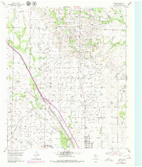
1954 Map of Brand
USGS Topo · Published 1956About this map
Industrial expansion and transit networks intersect at Brand during the mid-1950s. The landscape is defined by the extensive Kelly Snyder Field, where a dense grid of infrastructure supports the region's oil production, including scattered Oil Sumps and numerous unnamed wells and tanks. This activity is situated within a terrain carved by Ennis Creek, Horse Creek, and Hackberry Creek.
Find a feature on this map
11 named features on this map. Tap any name to fly to it.
Don’t see what you’re looking for? This feature index may not catch every label — zoom into the map to look around manually.
Map Details
Editions of this 1954 Brand Map
2 editions found
Other maps of this area

1952 · Snyder
USGS Topo · 1:24,000

1952 · Ira NE
USGS Topo · 1:24,000

1952 · Hermleigh
USGS Topo · 1:24,000

1954 · Lloyd Mountain
USGS Topo · 1:24,000

1954 · Dermott
USGS Topo · 1:24,000

1954 · Big Spring
USGS Topo · 1:250,000

1958 · Big Spring
USGS Topo · 1:250,000

1969 · Maverick Creek
USGS Topo · 1:24,000

1969 · Flat Top Mountain
USGS Topo · 1:24,000
1969 · McKenzie Mountains
USGS Topo · 1:24,000