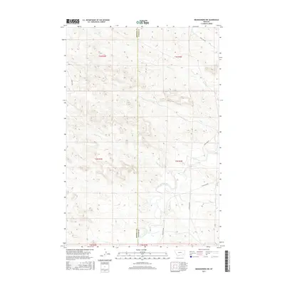
2017 Map of Brandenberg NW
USGS Topo · Published 2017About this map
The Tongue River meanders through this section of southeastern Montana, marking the southern reaches of the quadrangle where it is paralleled by Tongue River Rd. This drainage-rich landscape is defined by the boundary between Rosebud Co and Custer Co, which bisects the area vertically. Significant tributaries including Cottonwood Cr, Dry Cr, and Liscom Cr feed into the river valley from the surrounding breaks.
Find a feature on this map
20 named features on this map. Tap any name to fly to it.
Don’t see what you’re looking for? This feature index may not catch every label — zoom into the map to look around manually.
Map Details
Editions of this 2017 Brandenberg NW Map
This is the sole edition of this map. No revisions or reprints were ever made.
Other maps of this area

1954 · Hardin
USGS Topo · 1:250,000

1954 · Forsyth
USGS Topo · 1:250,000

1957 · Hardin
USGS Topo · 1:250,000

1957 · Forsyth
USGS Topo · 1:250,000

1958 · Forsyth
USGS Topo · 1:250,000

1958 · Hardin
USGS Topo · 1:250,000
1969 · Miller Creek
USGS Topo · 1:24,000
1969 · Miller Creek SW
USGS Topo · 1:24,000
1971 · Brandenberg NW
USGS Topo · 1:24,000

1971 · Hammond Draw
USGS Topo · 1:24,000