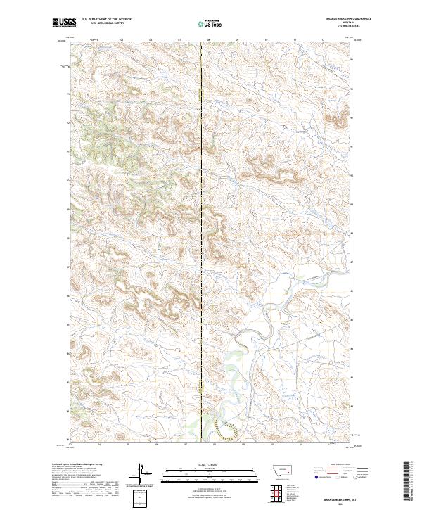
2024 Map of Brandenberg NW
USGS Topo · Published 2024About this map
The Tongue River carves a winding path through the southeastern corner of this landscape, marking a vital water source in the high plains of eastern Montana. This area, straddling the boundary between Rosebud Co and Custer Co, is defined by a complex network of seasonal drainages including Cottonwood Creek and Coal Creek. The presence of the S H Ditch near the river suggests the ongoing importance of managed water for agriculture in this arid environment.
Find a feature on this map
20 named features on this map. Tap any name to fly to it.
Don’t see what you’re looking for? This feature index may not catch every label — zoom into the map to look around manually.
Map Details
Editions of this 2024 Brandenberg NW Map
This is the sole edition of this map. No revisions or reprints were ever made.
Other maps of this area

1954 · Hardin
USGS Topo · 1:250,000

1954 · Forsyth
USGS Topo · 1:250,000

1957 · Hardin
USGS Topo · 1:250,000

1957 · Forsyth
USGS Topo · 1:250,000

1958 · Forsyth
USGS Topo · 1:250,000

1958 · Hardin
USGS Topo · 1:250,000
1969 · Miller Creek
USGS Topo · 1:24,000
1969 · Miller Creek SW
USGS Topo · 1:24,000
1971 · Brandenberg NW
USGS Topo · 1:24,000

1971 · Hammond Draw
USGS Topo · 1:24,000