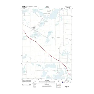
2010 Map of Brandon
USGS Topo · Published 2010About this map
Brandon serves as the central hub of this Douglas County landscape, where the Brandon Post Office and Brandon Cemetery mark the historic core of the village. The surrounding terrain is defined by an intricate network of glacial lakes and wetlands, including the expansive Lobster Lake in the south and Chippewa Lake to the north. For those tracing local families, the map identifies several distinct burial grounds scattered across the township, such as Chippewa Cemetery, East Moe Cemetery, and West Moe Cemetery. The presence of recreation sites like Acorn Acres Resort and Campground and Oak Park Campground highlights the transition of the area from a purely agricultural and rail-focused region into a notable destination for lakeside leisure. Significant water bodies like Elizabeth Lake and Lake Williams dominate the central topography, interspersed with rural routes like County Hwy-7 NW and the Central Lakes Trl.
Find a feature on this map
77 named features on this map. Tap any name to fly to it.
Don’t see what you’re looking for? This feature index may not catch every label — zoom into the map to look around manually.
Map Details
Editions of this 2010 Brandon Map
This is the sole edition of this map. No revisions or reprints were ever made.
Other maps of this area

1953 · Brainerd
USGS Topo · 1:250,000

1953 · Saint Cloud
USGS Topo · 1:250,000

1957 · Brainerd
USGS Topo · 1:250,000

1957 · Saint Cloud
USGS Topo · 1:250,000

1958 · Saint Cloud
USGS Topo · 1:250,000

1958 · Brainerd
USGS Topo · 1:250,000

1965 · Brainerd
USGS Topo · 1:250,000

1966 · Brandon
USGS Topo · 1:24,000

1966 · Alexandria West
USGS Topo · 1:24,000

1966 · Farwell
USGS Topo · 1:24,000