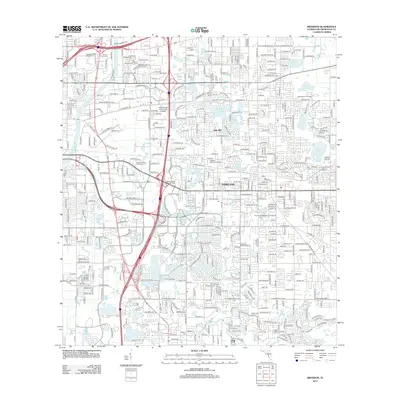
2012 Map of Brandon
USGS Topo · Published 2012About this map
Oak Hill and the residential corridors of Parkland define this suburban landscape east of Tampa during the early 21st century. The map reveals an intricate network of planned developments and water management, where numerous small lakes like Mango Lake, Gornto Lake, and Valrico Lake are woven into the street grid. Educational and commercial hubs are central to the community's layout, anchored by the Hillsborough Community College campus and large professional complexes such as the Pinelake Office Park and Parsons Professional Park.
Find a feature on this map
62 named features on this map. Tap any name to fly to it.
Don’t see what you’re looking for? This feature index may not catch every label — zoom into the map to look around manually.
Map Details
Editions of this 2012 Brandon Map
This is the sole edition of this map. No revisions or reprints were ever made.
Other maps of this area

1921 · Tampa
USGS Topo · 1:62,500

1943 · Thonotosassa
USGS Topo · 1:24,000

1944 · Sulphur Springs
USGS Topo · 1:31,680

1944 · Mango
USGS Topo · 1:31,680

1944 · Tampa
USGS Topo · 1:31,680

1944 · Thonotosassa
USGS Topo · 1:31,680

1944 · Antioch
USGS Topo · 1:31,680

1944 · Balm
USGS Topo · 1:31,680

1945 · Gadsden Point
USGS Topo · 1:31,680

1945 · Sulphur Springs
USGS Topo · 1:31,680