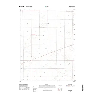
2017 Map of Brandon
USGS Topo · Published 2017About this map
The settlement of Brandon serves as the focal point of this southwestern Perkins County landscape, situated along a primary transportation corridor that cuts diagonally across the High Plains terrain. The area is defined by the ephemeral drainage of Spring Cr, which meanders through the section lines, shaping the agricultural layout of the region. This 2017 survey reflects the persistent grid-based land management of rural Nebraska, where the intersection of Burke Street and local section roads anchors the community. Outside the immediate cluster of Brandon, the map reveals a sparsely populated expanse characterized by seasonal watercourses and the infrastructure required to maintain connectivity across the vast open spaces of the Great Plains.
Find a feature on this map
2 named features on this map. Tap any name to fly to it.
Don’t see what you’re looking for? This feature index may not catch every label — zoom into the map to look around manually.
Map Details
Editions of this 2017 Brandon Map
This is the sole edition of this map. No revisions or reprints were ever made.
Other maps of this area

1954 · Sterling
USGS Topo · 1:250,000

1954 · McCook
USGS Topo · 1:250,000

1957 · McCook
USGS Topo · 1:250,000

1958 · McCook
USGS Topo · 1:250,000

1958 · Sterling
USGS Topo · 1:250,000

1961 · Brandon NE
USGS Topo · 1:24,000

1961 · Lamar NE
USGS Topo · 1:24,000

1961 · Brandon NW
USGS Topo · 1:24,000

1961 · Brandon SE
USGS Topo · 1:24,000

1961 · Lamar NW
USGS Topo · 1:24,000