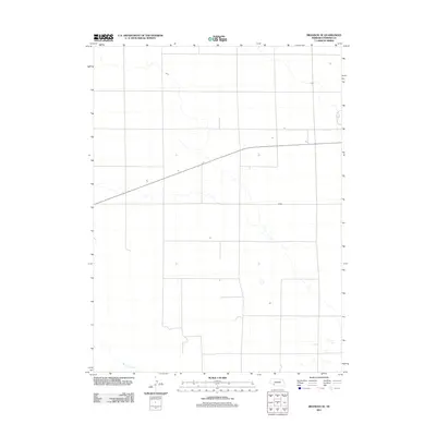
2011 Map of Brandon SE
USGS Topo · Published 2011About this map
Spring Creek meanders across the southwestern corner of this Perkins County landscape, providing a rare water source in an area dominated by high plains agriculture. The terrain is defined by a sparse, geometric road network that reflects the modern land management and irrigation patterns of the early 21st century. This survey, conducted by the U.S. Geological Survey, captures the quiet, open character of the Nebraska panhandle region, where long stretches of undeveloped land are punctuated only by isolated agricultural structures and intermittent drainage features. The minimal naming on this sheet underscores the open and agrarian nature of the territory south of the regional hubs.
Find a feature on this map
1 named feature on this map. Tap any name to fly to it.
Don’t see what you’re looking for? This feature index may not catch every label — zoom into the map to look around manually.
Map Details
Editions of this 2011 Brandon SE Map
This is the sole edition of this map. No revisions or reprints were ever made.
Other maps of this area

1954 · McCook
USGS Topo · 1:250,000

1957 · McCook
USGS Topo · 1:250,000

1958 · McCook
USGS Topo · 1:250,000

1961 · Brandon NE
USGS Topo · 1:24,000

1961 · Lamar NE
USGS Topo · 1:24,000

1961 · Brandon NW
USGS Topo · 1:24,000

1961 · Brandon SE
USGS Topo · 1:24,000

1961 · Lamar NW
USGS Topo · 1:24,000

1961 · Brandon
USGS Topo · 1:24,000
1973 · Grant
USGS Topo · 1:24,000