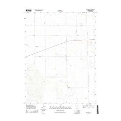
2014 Map of Brandon SE
USGS Topo · Published 2014About this map
Spring Cr meanders through the southwestern corner of this Perkins County landscape, providing a rare break in the geometric regularity of the section line road network. This region of Nebraska is characterized by a sprawling grid of rural corridors, including Road 762 and Road 324, which define the agricultural boundaries and access points for the high plains. The terrain is marked by subtle topographic variations and depressions typical of the Nebraska Sandhills periphery. The concentration of designated routes such as Road 754 and Road 758 highlights the essential infrastructure required to support the large-scale ranching and farming operations that dominate this part of the state in the early 21st century.
Find a feature on this map
13 named features on this map. Tap any name to fly to it.
Don’t see what you’re looking for? This feature index may not catch every label — zoom into the map to look around manually.
Map Details
Editions of this 2014 Brandon SE Map
This is the sole edition of this map. No revisions or reprints were ever made.
Other maps of this area

1954 · McCook
USGS Topo · 1:250,000

1957 · McCook
USGS Topo · 1:250,000

1958 · McCook
USGS Topo · 1:250,000

1961 · Brandon NE
USGS Topo · 1:24,000

1961 · Lamar NE
USGS Topo · 1:24,000

1961 · Brandon NW
USGS Topo · 1:24,000

1961 · Brandon SE
USGS Topo · 1:24,000

1961 · Lamar NW
USGS Topo · 1:24,000

1961 · Brandon
USGS Topo · 1:24,000
1973 · Grant
USGS Topo · 1:24,000