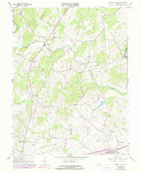
1966 Map of Brandy Station
USGS Topo · Published 1990About this map
Brandy Station and the rolling agricultural lands of Culpeper County are meticulously detailed in this mid-century survey, showcasing a landscape defined by its river systems and rural outposts. The Hazel River winds through the central portion of the sheet, joined by numerous tributaries like Muddy Run and Ruffans Run, while the Rappahannock River forms the eastern boundary with Fauquier County. This geography dictated the placement of early infrastructure, from the Kerrick Bridge crossing to the Southern railroad line that anchored the community at Brandy Station.
Find a feature on this map
35 named features on this map. Tap any name to fly to it.
Don’t see what you’re looking for? This feature index may not catch every label — zoom into the map to look around manually.
Map Details
Editions of this 1966 Brandy Station Map
3 editions found
Other maps of this area

1887 · Spottsylvania
USGS Topo · 1:125,000

1892 · Spottsylvania
USGS Topo · 1:125,000

1892 · Gordonsville
USGS Topo · 1:125,000

1893 · Luray
USGS Topo · 1:125,000

1894 · Warrenton
USGS Topo · 1:125,000

1894 · Warrenton
USGS Topo · 1:62,500

1905 · Luray
USGS Topo · 1:125,000

1927 · Remington
USGS Topo · 1:48,000

1930 · Warrenton
USGS Topo · 1:62,500

1943 · Germanna Bridge
USGS Topo · 1:24,000