
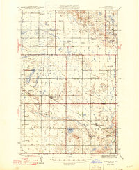
1946 Map of Brantford
USGS Topo · Published 1946About this map
The Great Northern railway cuts diagonally through this Central North Dakota landscape, anchoring the prairie settlements of Brantford and Grace City during the mid-1940s. The region is defined by a dense network of local township schools such as Smith Sch No 1 and Columbia Sch, illustrating the dispersed but organized rural education system of the era. The terrain transitions from the high ground of Tiffany and Pleasant Prairie down to the meandering James River valley in the south, where water features like Blue Cloud Lake and Rusten Slough punctuate the glacial till. Genealogical interest is concentrated at sites like Kvernes Ch and the Grace City Cem, while the small station at Juanita marks the rail line’s eastward path toward the Foster County border.
Find a feature on this map
27 named features on this map. Tap any name to fly to it.
Don’t see what you’re looking for? This feature index may not catch every label — zoom into the map to look around manually.
Map Details
Editions of this 1946 Brantford Map
2 editions found
Other maps of this area

1900 · Pingree
USGS Topo · 1:125,000

1928 · Tokio
USGS Topo · 1:62,500

1930 · Hamar
USGS Topo · 1:62,500

1931 · Oberon
USGS Topo · 1:62,500

1931 · Tokio
USGS Topo · 1:62,500

1944 · Brantford
USGS Topo · 1:62,500

1948 · New Rockford
USGS Topo · 1:62,500

1948 · Carrington
USGS Topo · 1:62,500

1949 · Grace City
USGS Topo · 1:24,000

1950 · Carrington East
USGS Topo · 1:24,000