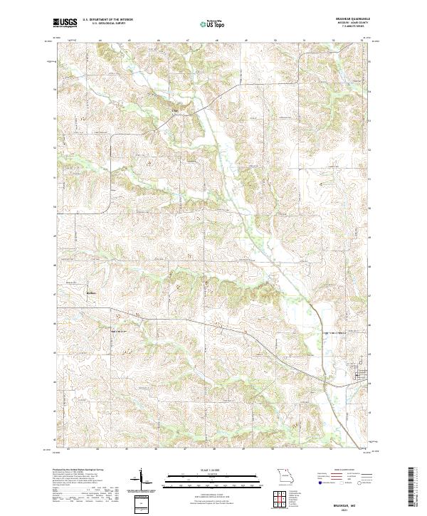
2021 Map of Brashear
USGS Topo · Published 2021About this map
N Fork Salt River and its various tributaries, including Floyd Cr and Steer Cr, define the agricultural landscape of eastern Adair County. The area is characterized by a network of rural routes such as Sperry Way and Hazel Green Way, connecting the small settlements of Clay and Bullion. In the northeastern corner, the headwaters of the S Fork S Fabius River emerge, while Patten Lake provides a notable point of interest in the western portion of the quadrangle. The terrain is marked by numerous named creek branches like Hog Br and Bee Br, which drain the undulating farmland. This modern survey reflects the enduring rural character of the region, where family-named roads and historic place names like Clay persist alongside contemporary transportation infrastructure like State Hwy J.
Find a feature on this map
75 named features on this map. Tap any name to fly to it.
Don’t see what you’re looking for? This feature index may not catch every label — zoom into the map to look around manually.
Map Details
Editions of this 2021 Brashear Map
This is the sole edition of this map. No revisions or reprints were ever made.
Other maps of this area

1903 · Edina
USGS Topo · 1:125,000

1911 · Queen City
USGS Topo · 1:62,500

1913 · Queen City
USGS Topo · 1:62,500

1938 · Kirksville
USGS Topo · 1:62,500

1940 · Kirksville
USGS Topo · 1:62,500

1954 · Centerville
USGS Topo · 1:250,000

1957 · Centerville
USGS Topo · 1:250,000

1958 · Centerville
USGS Topo · 1:250,000
1965 · Locust Hill
USGS Topo · 1:24,000

1966 · Brashear
USGS Topo · 1:24,000