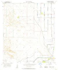
1957 Map of Brawley NW
USGS Topo · Published 1958About this map
Tamarack Ranch and a complex network of desert irrigation define this mid-century landscape in the Imperial Valley. The terrain is bifurcated by the sea-level line, with the western portion dominated by the Naval Reservation and its associated Firing Range, while the eastern portion is heavily engineered for agriculture. This transition from arid, undeveloped land to a structured grid of canals and drains highlights the intensive water management efforts of the 1950s led by Harvey O. Banks and the State of California. Significant water features like the Westside Main Canal, Thistle Canal, and Tokay Drain support the local economy, alongside industrial markers such as Gravel Pits and Grain Tanks. The New River winds through the southern edge, flanked by a series of levees and spoil banks designed to control flow across this low-lying basin.
Find a feature on this map
22 named features on this map. Tap any name to fly to it.
Don’t see what you’re looking for? This feature index may not catch every label — zoom into the map to look around manually.
Map Details
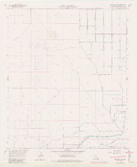
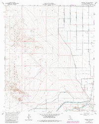
Editions of this 1957 Brawley NW Map
3 editions found
Other maps of this area

1915 · El Centro
USGS Topo · 1:125,000

1940 · Brawley
USGS Topo · 1:62,500

1940 · Kane Spring
USGS Topo · 1:62,500

1940 · Plaster City
USGS Topo · 1:62,500

1942 · El Centro
USGS Topo · 1:250,000

1943 · Brawley
USGS Topo · 1:62,500

1944 · Plaster City
USGS Topo · 1:62,500

1944 · Kane Spring
USGS Topo · 1:62,500

1944 · Calipatria
USGS Topo · 1:62,500

1954 · El Centro
USGS Topo · 1:250,000