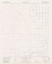
1957 Map of Brawley NW
USGS Topo · Published 1979About this map
Military testing grounds and heavy irrigation infrastructure dominate this Imperial County landscape. The El Centro Naval Reservation Boundary encloses a significant portion of the western terrain, featuring specialized zones such as the Parachute Range, Recovery Test Range, and a Firing Range. These tactical areas contrast sharply with the eastern agricultural development, where a complex network of man-made waterways like the Westside Main Canal and Thistle Canal support the arid valley's farm economy.
Find a feature on this map
33 named features on this map. Tap any name to fly to it.
Don’t see what you’re looking for? This feature index may not catch every label — zoom into the map to look around manually.
Map Details
Editions of this 1957 Brawley NW Map
3 editions found
Other maps of this area

1915 · El Centro
USGS Topo · 1:125,000

1940 · Brawley
USGS Topo · 1:62,500

1940 · Kane Spring
USGS Topo · 1:62,500

1940 · Plaster City
USGS Topo · 1:62,500

1942 · El Centro
USGS Topo · 1:250,000

1943 · Brawley
USGS Topo · 1:62,500

1944 · Plaster City
USGS Topo · 1:62,500

1944 · Kane Spring
USGS Topo · 1:62,500

1944 · Calipatria
USGS Topo · 1:62,500

1954 · El Centro
USGS Topo · 1:250,000