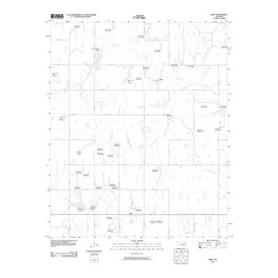
2010 Map of Bray
USGS Topo · Published 2010About this map
Bray and the small community of Bailey anchor this section of Stephens County, where a complex network of water management defines the prairie landscape. The area is dominated by the upper reaches of Rush Creek and its numerous tributaries, including Fourmile Creek, Murray Creek, and Coon Creek. A massive infrastructure of flood control is evident through dozens of numbered dam sites, such as Rush Creek Site 8 Dam and Rush Creek Site 45 Dam, which create small reservoirs across the quadrangle. Transportation is organized around a strict section-line road grid, featuring routes like Goad Rd and Sandhill. On the western edge of the territory, the Alford A Bratchar Airport provides a distinct aviation landmark among the drainage basins of Clear Creek and Dry Creek.
Find a feature on this map
67 named features on this map. Tap any name to fly to it.
Don’t see what you’re looking for? This feature index may not catch every label — zoom into the map to look around manually.
Map Details
Editions of this 2010 Bray Map
This is the sole edition of this map. No revisions or reprints were ever made.
Other maps of this area

1902 · Rush Springs
USGS Topo · 1:125,000

1949 · Rush Springs
USGS Topo · 1:62,500

1950 · Rush Springs
USGS Topo · 1:62,500

1950 · Marlow
USGS Topo · 1:62,500

1951 · Marlow
USGS Topo · 1:62,500

1957 · Ardmore
USGS Topo · 1:250,000

1963 · Ardmore
USGS Topo · 1:250,000

1966 · Lindsay SW
USGS Topo · 1:24,000
1974 · Cox City
USGS Topo · 1:24,000
1974 · Lake Fuqua
USGS Topo · 1:24,000