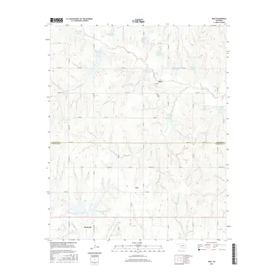
2016 Map of Bray
USGS Topo · Published 2016About this map
Bray and Bailey serve as the primary residential centers in this rural Oklahoma landscape, which straddles the boundary between Grady and Stephens counties. The terrain is characterized by a sophisticated network of flood control and water management structures, notably the numerous numbered Rush Creek Site reservoirs, such as Rush Creek Site 13 Reservoir and Rush Creek Site 18 Reservoir. These man-made features are interspersed with natural drainage systems including Fourmile Creek, Coon Creek, and Clear Creek. In the southern portion of the map, the northern outskirts of Duncan appear, showing the transition from agricultural land to more developed street grids. A significant local landmark, the Bailey Cemetery, provides a point of genealogical interest north of the Bray community, while local roads like Hall Road and Ballpark Road delineate the township's layout.
Find a feature on this map
40 named features on this map. Tap any name to fly to it.
Don’t see what you’re looking for? This feature index may not catch every label — zoom into the map to look around manually.
Map Details
Editions of this 2016 Bray Map
This is the sole edition of this map. No revisions or reprints were ever made.
Other maps of this area

1902 · Rush Springs
USGS Topo · 1:125,000

1949 · Rush Springs
USGS Topo · 1:62,500

1950 · Rush Springs
USGS Topo · 1:62,500

1950 · Marlow
USGS Topo · 1:62,500

1951 · Marlow
USGS Topo · 1:62,500

1957 · Ardmore
USGS Topo · 1:250,000

1963 · Ardmore
USGS Topo · 1:250,000

1966 · Lindsay SW
USGS Topo · 1:24,000
1974 · Cox City
USGS Topo · 1:24,000
1974 · Lake Fuqua
USGS Topo · 1:24,000