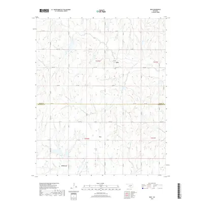
2018 Map of Bray
USGS Topo · Published 2018About this map
The Oklahoma prairie transitions across the Grady and Stephens County line, where the small communities of Bailey and Bray anchor a landscape defined by cattle country and seasonal drainage basins. The northern reach is characterized by the winding path of Rush Creek and Fourmile Creek, while the settlement of Bailey is marked by the central Bailey Cemetery. To the south, the terrain descends toward the outskirts of Duncan, influenced by the headwaters of Murray Creek, Bluff Creek, and Dry Creek. This 2018 survey illustrates a modern grid of rural county roads, such as Hall Road and Ballpark Road, that overlay the historic township and range system. The map provides a clear look at the intersection of rural residential life and the natural hydrology of the Great Plains, capturing the sparse but enduring network of settlements in this part of the state.
Find a feature on this map
30 named features on this map. Tap any name to fly to it.
Don’t see what you’re looking for? This feature index may not catch every label — zoom into the map to look around manually.
Map Details
Editions of this 2018 Bray Map
This is the sole edition of this map. No revisions or reprints were ever made.
Other maps of this area

1902 · Rush Springs
USGS Topo · 1:125,000

1949 · Rush Springs
USGS Topo · 1:62,500

1950 · Rush Springs
USGS Topo · 1:62,500

1950 · Marlow
USGS Topo · 1:62,500

1951 · Marlow
USGS Topo · 1:62,500

1957 · Ardmore
USGS Topo · 1:250,000

1963 · Ardmore
USGS Topo · 1:250,000

1966 · Lindsay SW
USGS Topo · 1:24,000
1974 · Cox City
USGS Topo · 1:24,000
1974 · Lake Fuqua
USGS Topo · 1:24,000