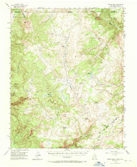
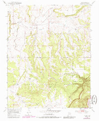
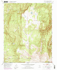
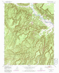
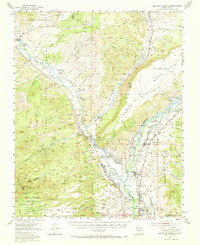
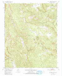
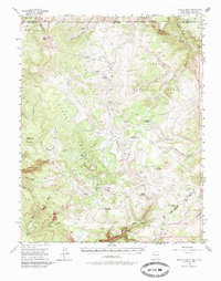
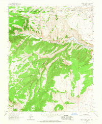
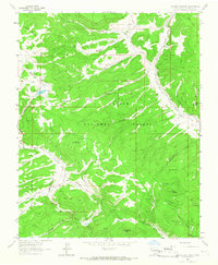
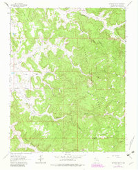
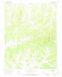
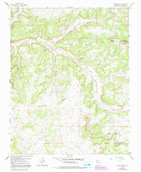
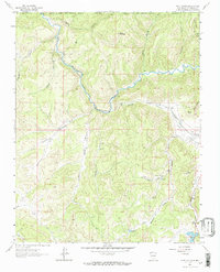
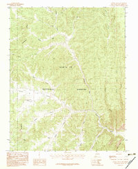
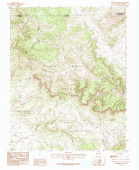
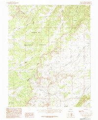
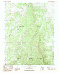
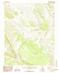
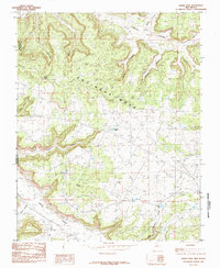
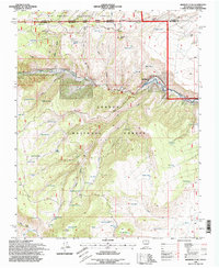
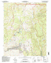
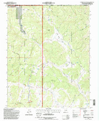
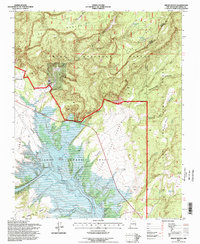
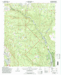
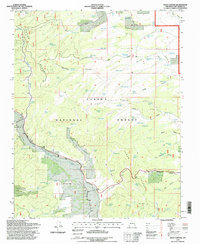
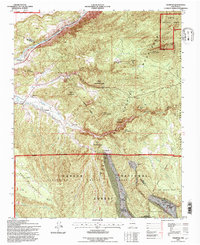
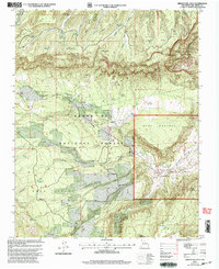
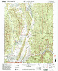
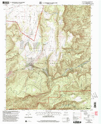
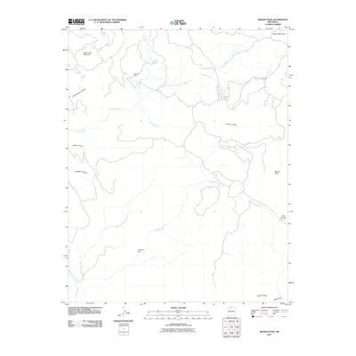
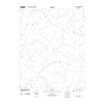
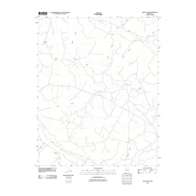
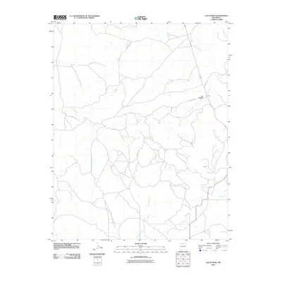
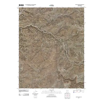
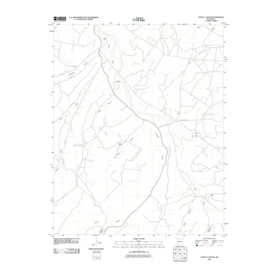
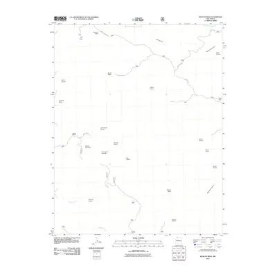
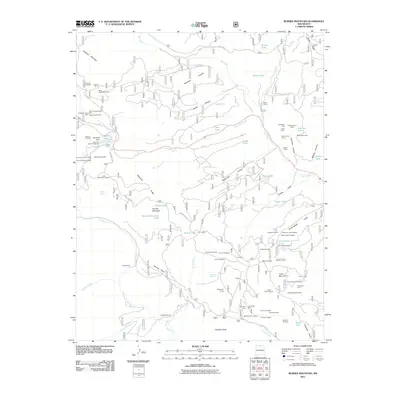
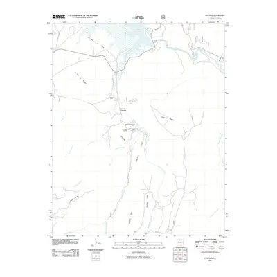
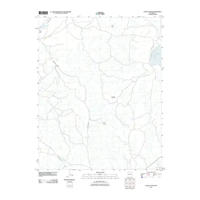
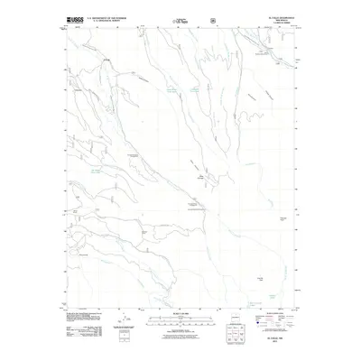
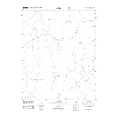
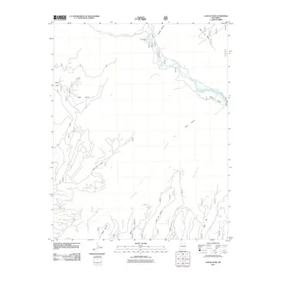
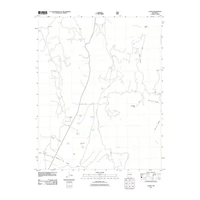
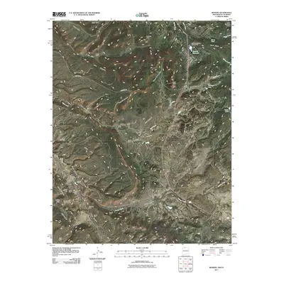
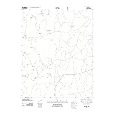
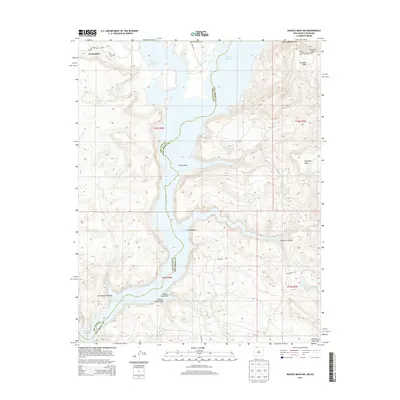
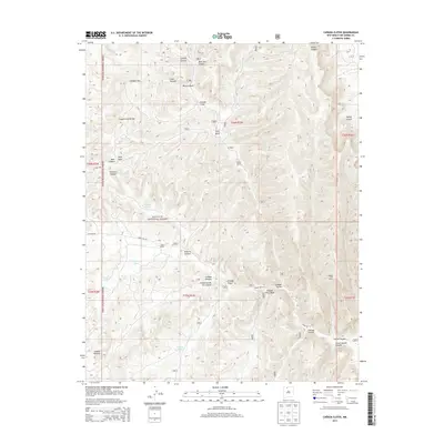
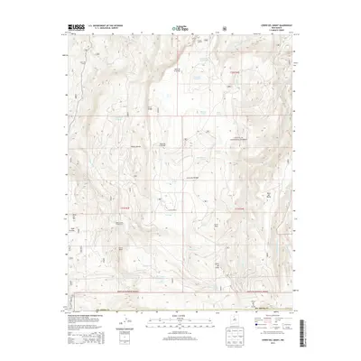
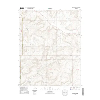
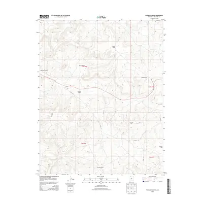
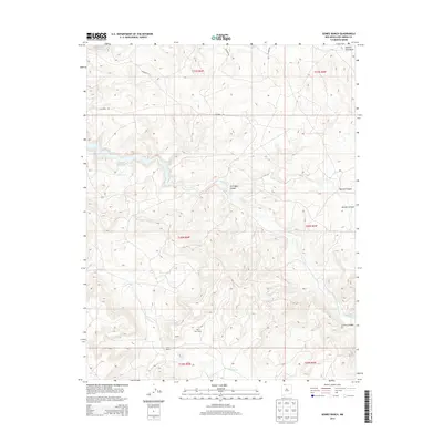
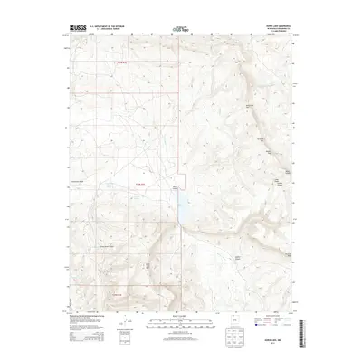
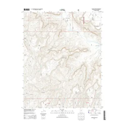
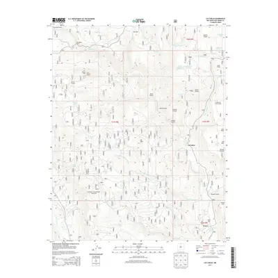
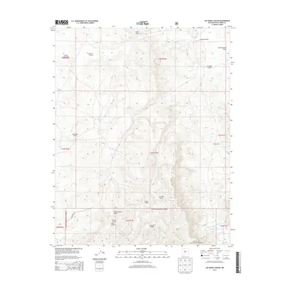
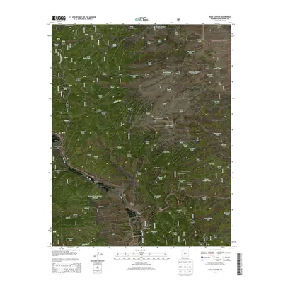
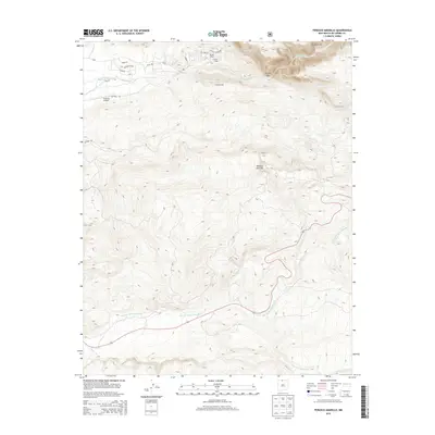
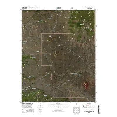
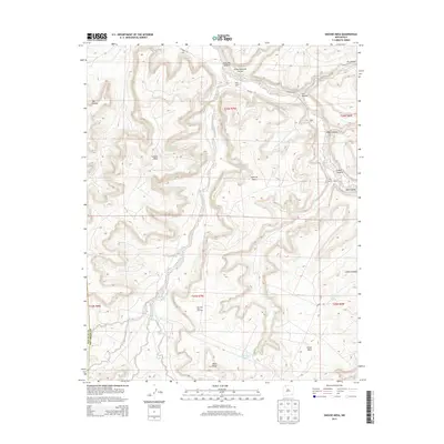
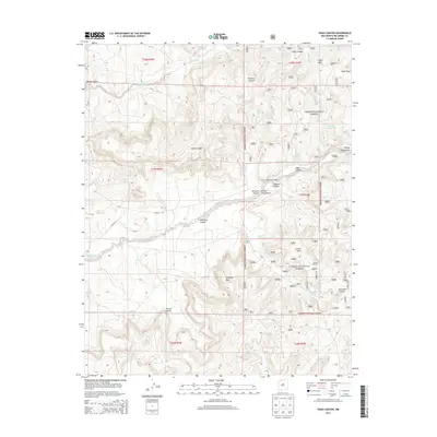
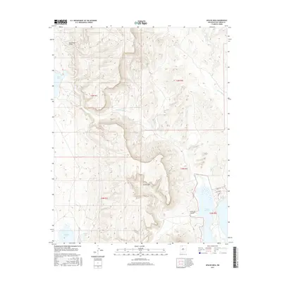
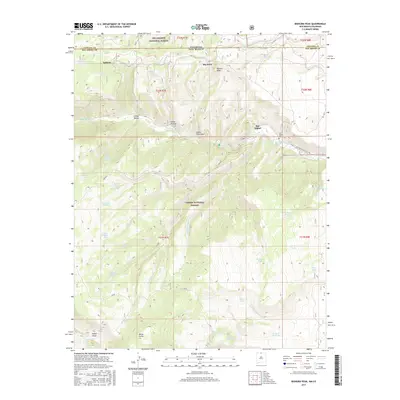
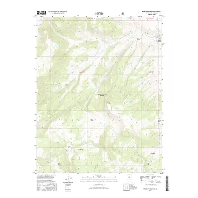
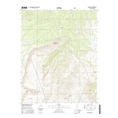
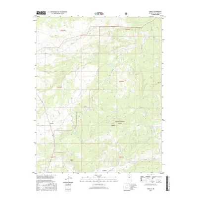
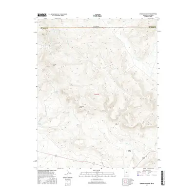
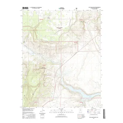
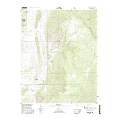
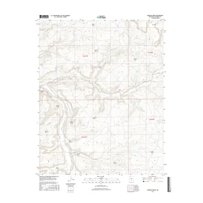
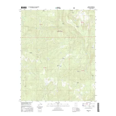
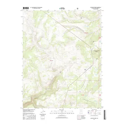
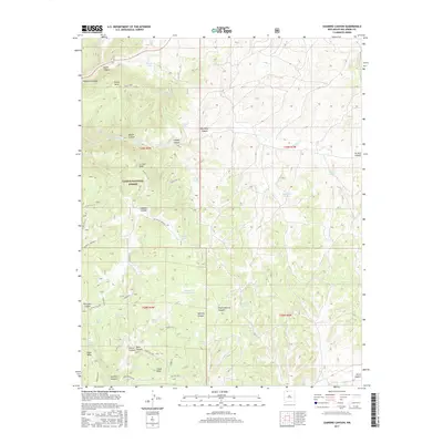
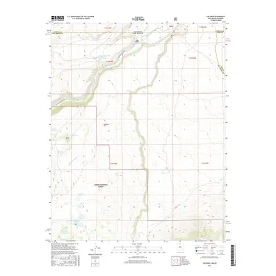
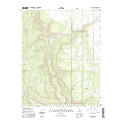
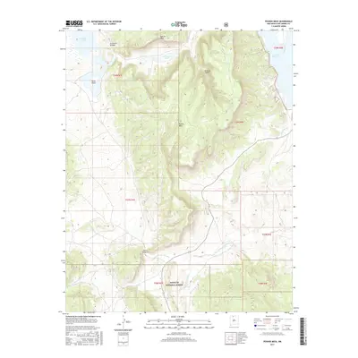
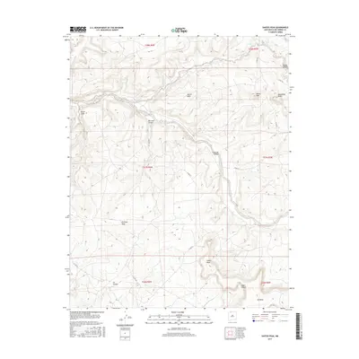
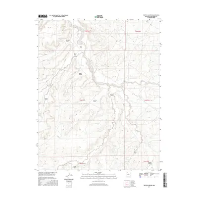
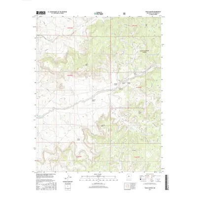
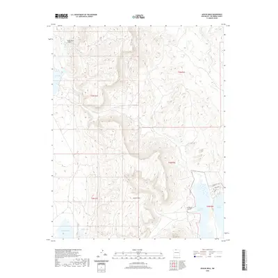
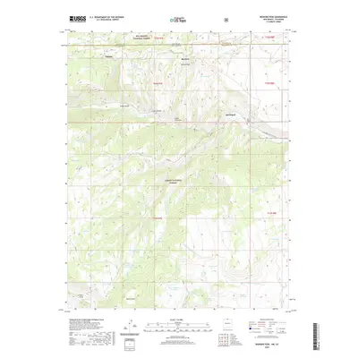
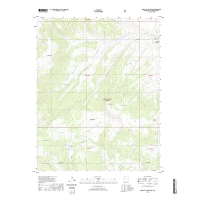
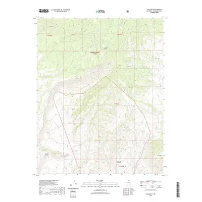
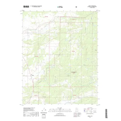
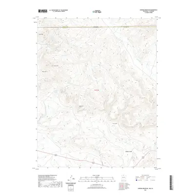
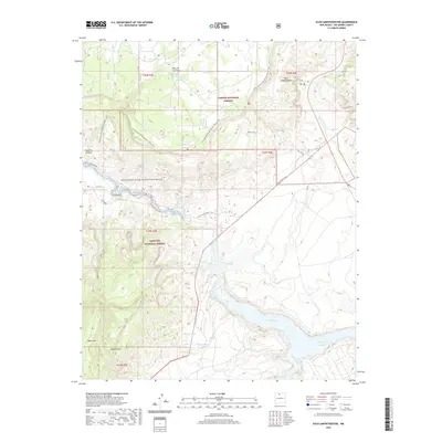
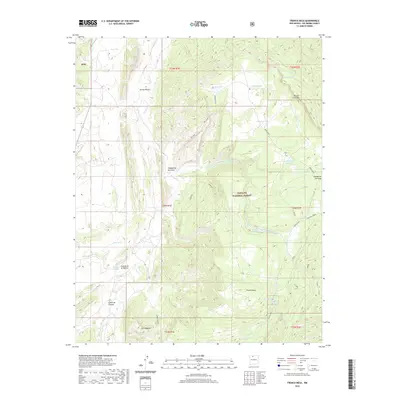
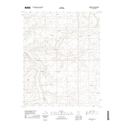
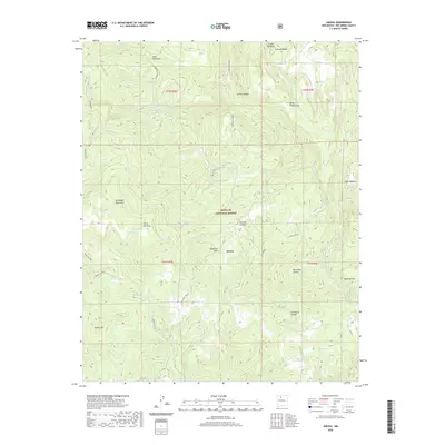
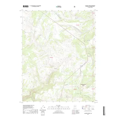
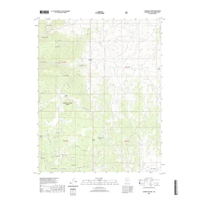
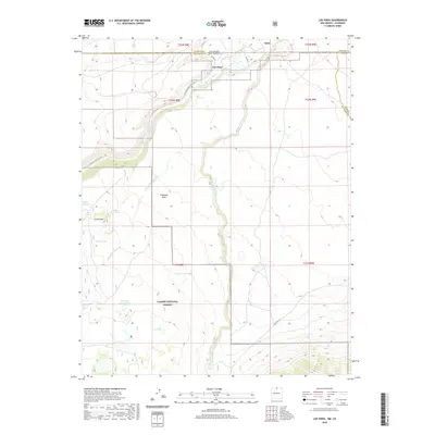
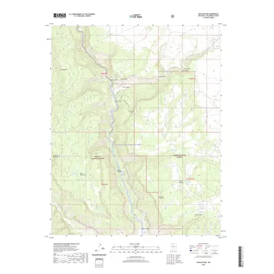
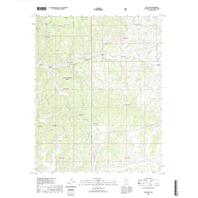
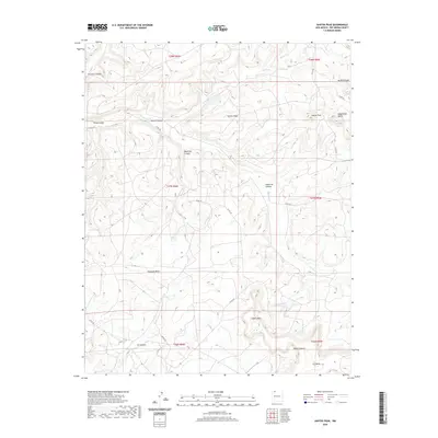
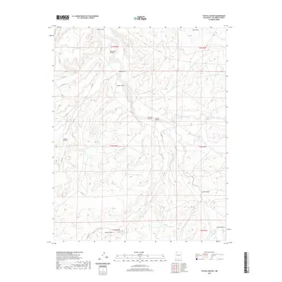
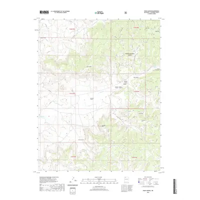
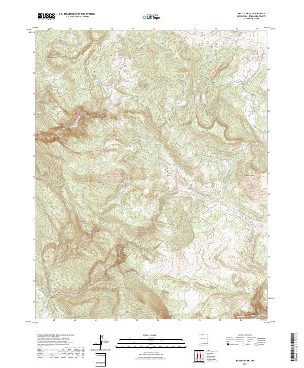
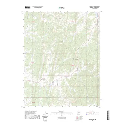
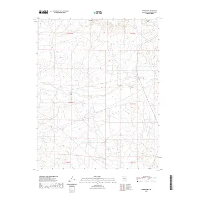
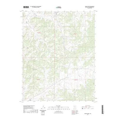
1955 Map of Brazos Peak
USGS Topo · Published 1971About this map
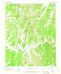
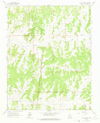
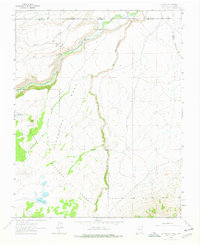
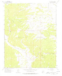
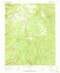
Tierra Amarilla Grant lands dominate the southern half of this mid-century survey, where the high-altitude terrain of Rio Arriba County meets the Colorado border. The landscape is defined by its seasonal grazing economy, evidenced by numerous historical outposts such as Brazos Cow Camp, Rivera Cow Camp, and Stewart Cow Camp. In the north, the Denver and Rio Grande Western railroad traces a precarious route through the Toltec Gorge along the Rio de los Pinos, marking a critical transportation corridor for the region's industry and early tourism. Notable elevations like Brazos Peak and the dramatic Brazos Cliffs overlook a complex network of canyons and watercourses, including Chaves Creek and the Rio Brazos. This 1955 field check preserves the location of isolated landmarks such as Huffaker Cabin and the Lagunitas Guard Station before modern development altered these remote reaches of the Carson National Forest.
Find a feature on this map
52 named features on this map. Tap any name to fly to it.
Don’t see what you’re looking for? This feature index may not catch every label — zoom into the map to look around manually.
Map Details
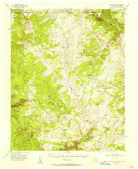
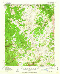
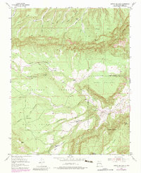
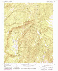
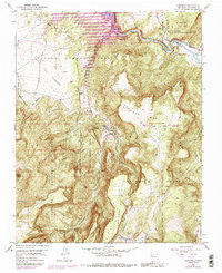
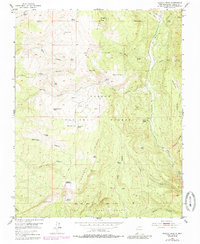
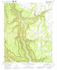
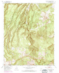
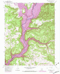
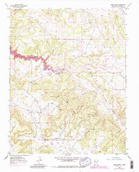
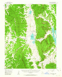
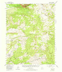
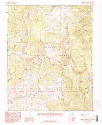
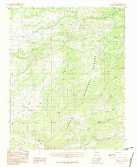
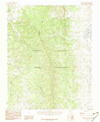
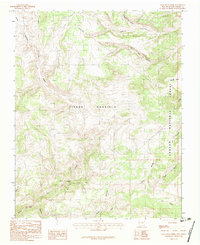
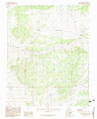
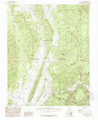
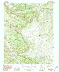
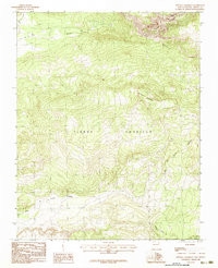
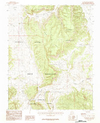
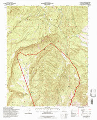
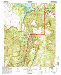
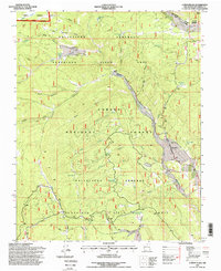
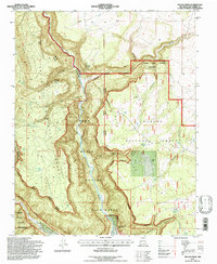
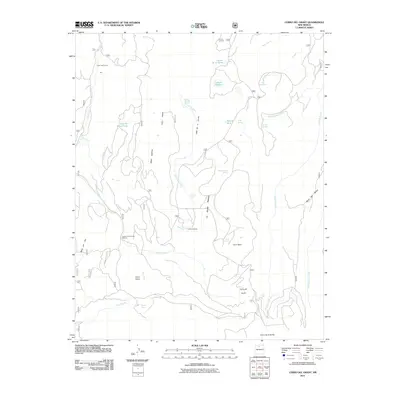
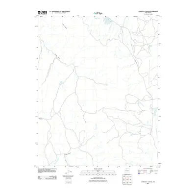
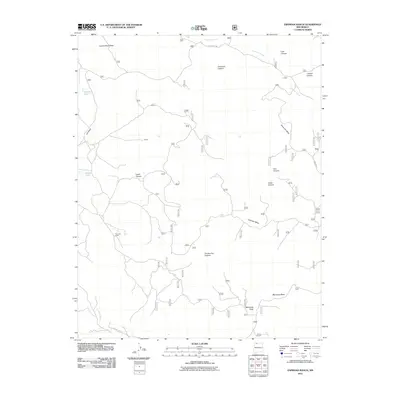
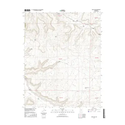
Editions of this 1955 Brazos Peak Map
4 editions found
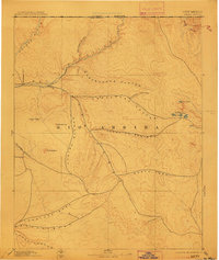
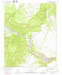
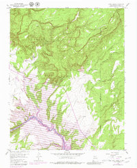
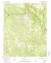
Historical Maps of Toltec Through Time
518 maps found

1889 Largo
Rio Arriba County, NM
1895 Largo
Rio Arriba County, NM

1918 Tusas
Rio Arriba County, NM
1953 Alire
Rio Arriba County, NM
1953 Arroyo Del Agua
Rio Arriba County, NM
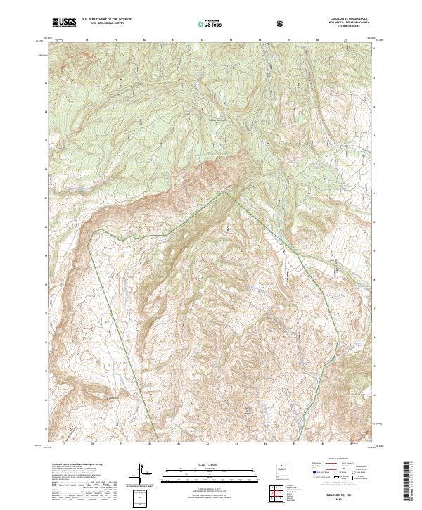
1953 Canjilon SE
Rio Arriba County, NM
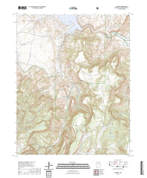
1953 Canones
Rio Arriba County, NM
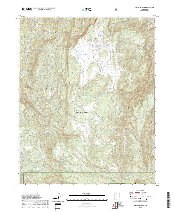
1953 Cerro Del Grant
Rio Arriba County, NM
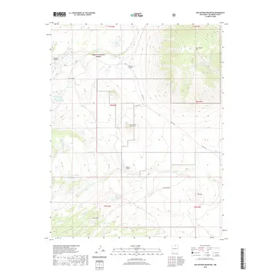
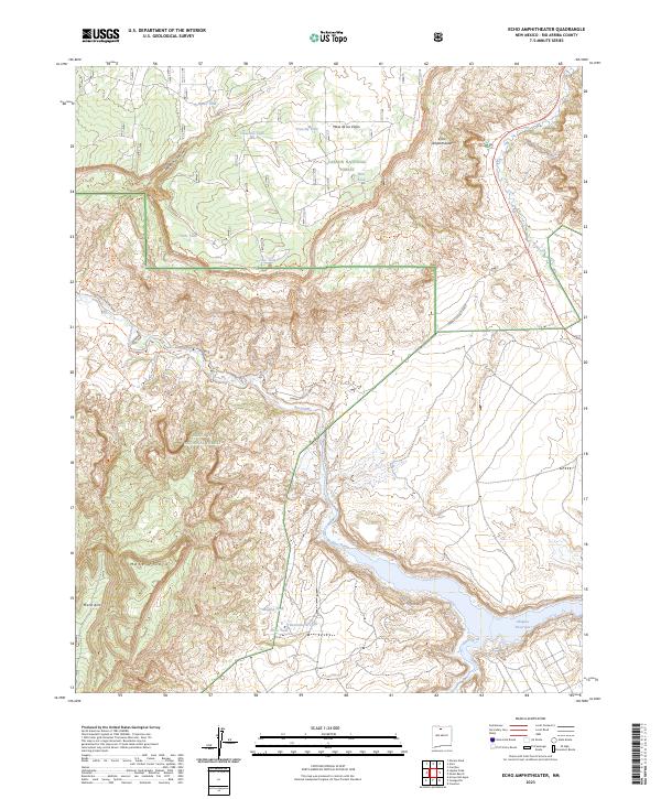
1953 Echo Ampitheater
Rio Arriba County, NM
1953 Ghost Ranch
Rio Arriba County, NM
1953 Jarosa
Rio Arriba County, NM
1953 Laguna Peak
Rio Arriba County, NM
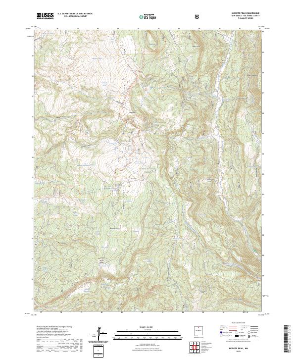
1953 Mogote Peak
Rio Arriba County, NM
1953 Navajo Peak
Rio Arriba County, NM
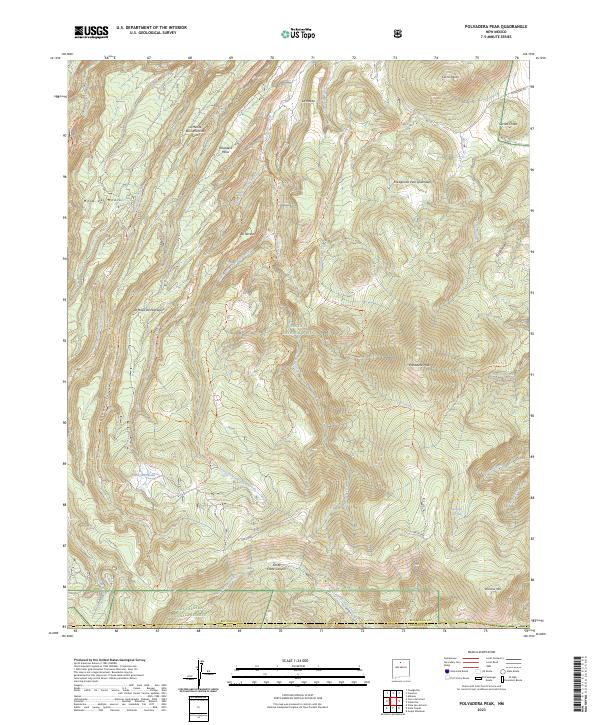
1953 Polvadera Peak
Rio Arriba County, NM
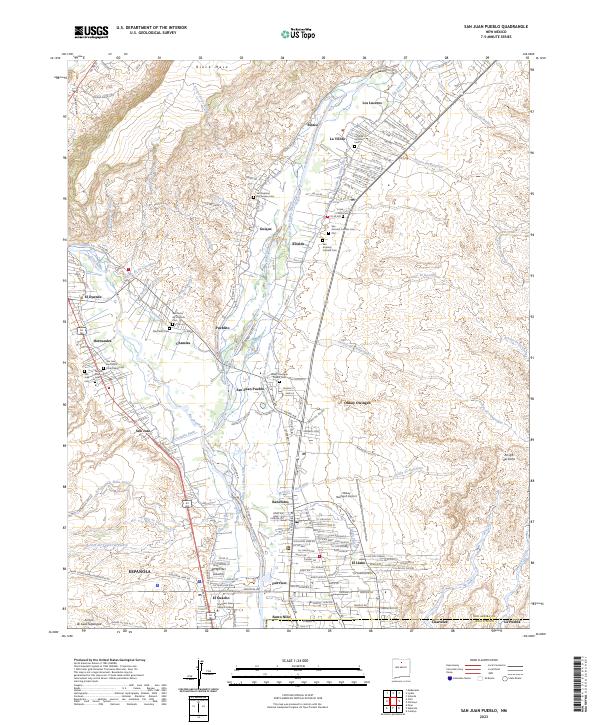
1953 San Juan Pueblo
Rio Arriba County, NM
1953 San Juan Pueblo
Rio Arriba County, NM
1953 Trampas
Rio Arriba County, NM
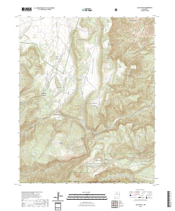
1953 Vallecitos
Rio Arriba County, NM
1953 Valle Grande Peak
Rio Arriba County, NM
1954 Bancos Mesa NW
Rio Arriba County, NM
1954 Gomez Ranch
Rio Arriba County, NM
1955 Boulder Lake
Rio Arriba County, NM
1955 Brazos Peak
Rio Arriba County, NM
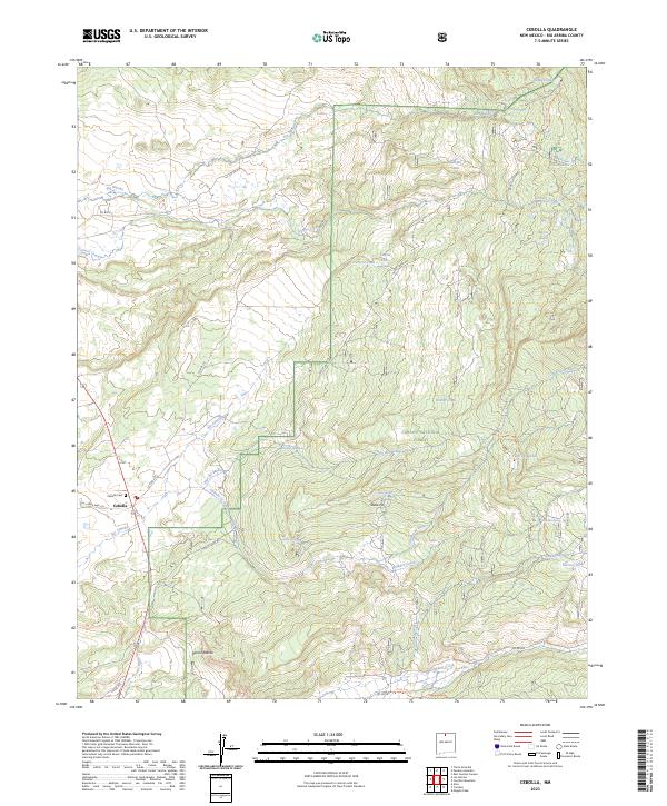
1955 Cebolla
Rio Arriba County, NM
1955 Llaves
Rio Arriba County, NM
1963 Bancos Mesa
Rio Arriba County, NM
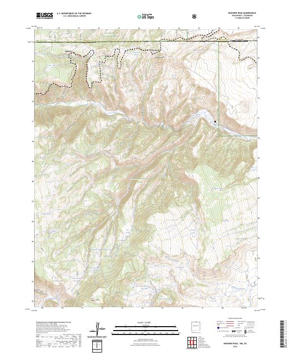
1963 Bighorn Peak
Rio Arriba County, NM
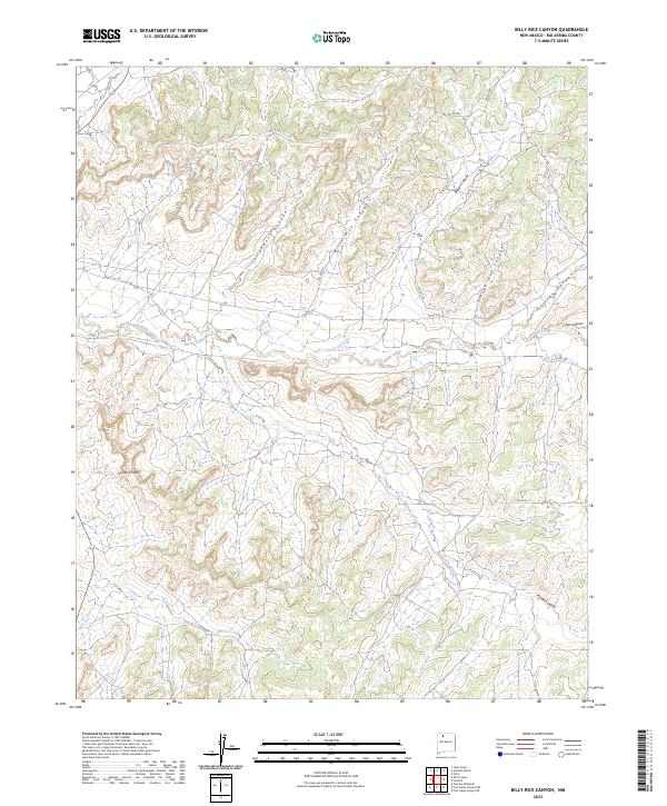
1963 Billy Rice Canyon
Rio Arriba County, NM
1963 Bixler Ranch
Rio Arriba County, NM
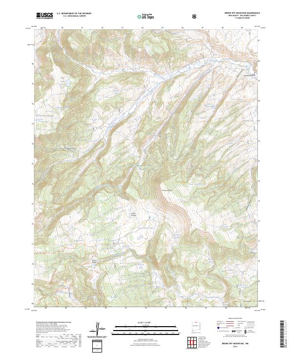
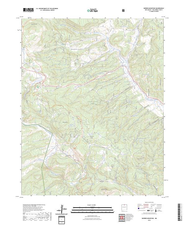
1963 Broke Off Mountain
Rio Arriba County, NM
1963 Burned Mountain
Rio Arriba County, NM
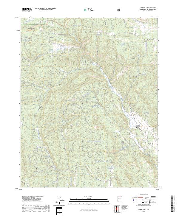
1963 Canon Plaza
Rio Arriba County, NM
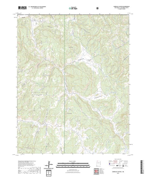
1963 Carracas Canyon
Rio Arriba County, NM
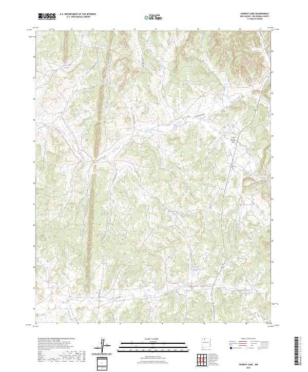
1963 Cement Lake
Rio Arriba County, NM
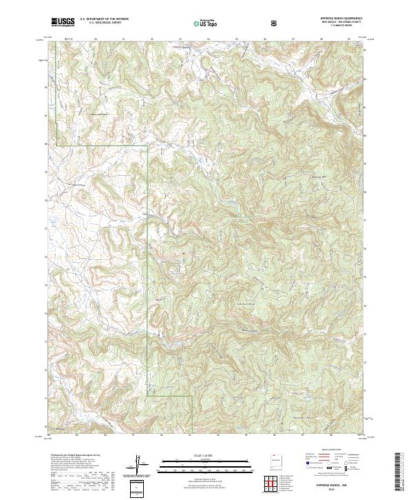
1963 Espinosa Ranch
Rio Arriba County, NM
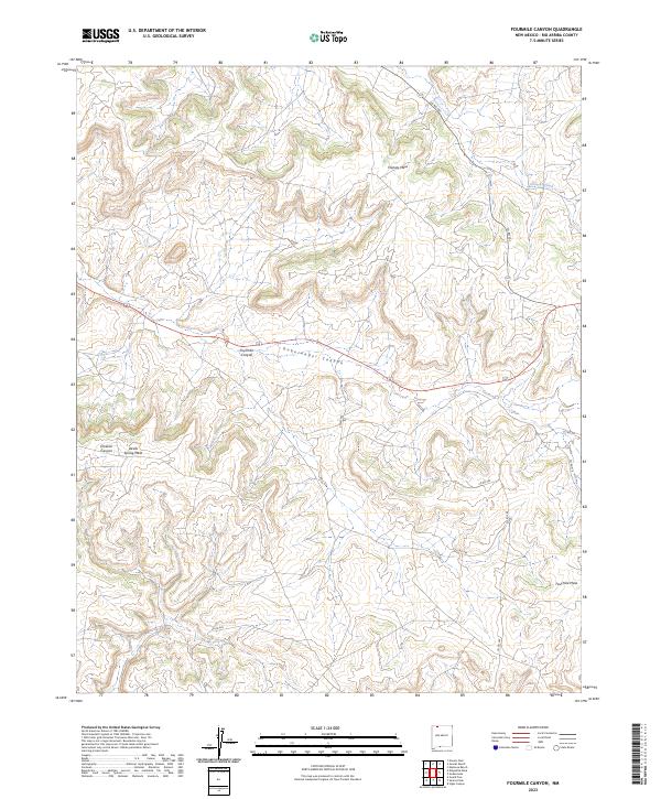
1963 Fourmile Canyon
Rio Arriba County, NM
1963 Gobernador
Rio Arriba County, NM
1963 Gonzales Mesa
Rio Arriba County, NM
1963 John Mills Lake
Rio Arriba County, NM
1963 Lapis Point
Rio Arriba County, NM
1963 Las Tablas
Rio Arriba County, NM
1963 Leandro Canyon
Rio Arriba County, NM
1963 Leavry Canyon
Rio Arriba County, NM
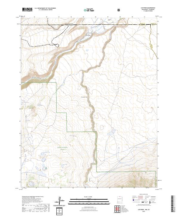
1963 Los Pinos
Rio Arriba County, NM
1963 Mule Canyon
Rio Arriba County, NM
1963 Nacimiento Peak
Rio Arriba County, NM
1963 Ojito
Rio Arriba County, NM
1963 Otero Store
Rio Arriba County, NM
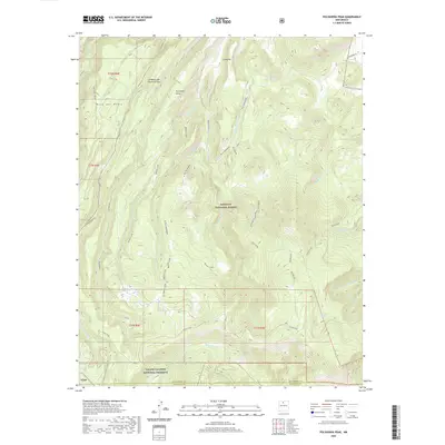
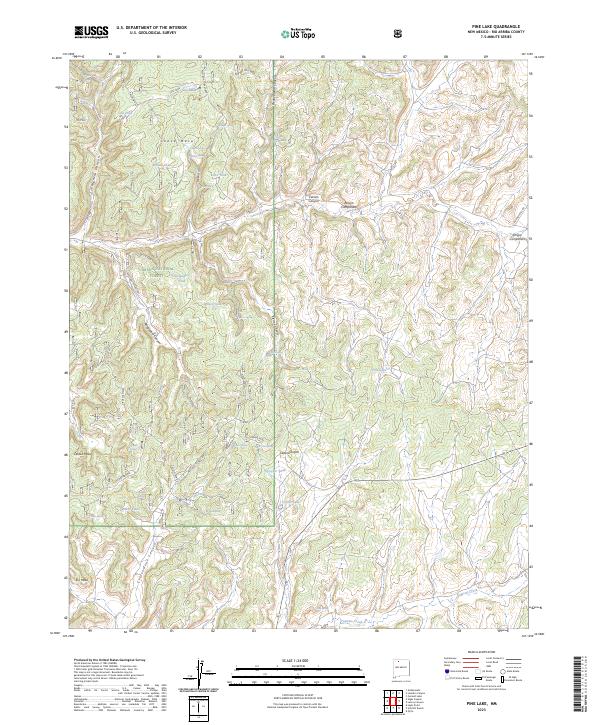
1963 Pine Lake
Rio Arriba County, NM
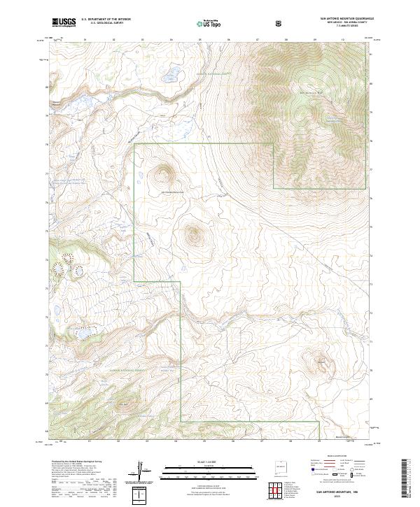
1963 San Antonio Mountain
Rio Arriba County, NM
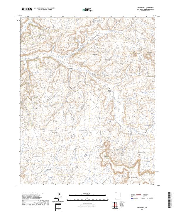
1963 Santos Peak
Rio Arriba County, NM
1963 Schmitz Ranch
Rio Arriba County, NM
1963 Tafoya Canyon
Rio Arriba County, NM
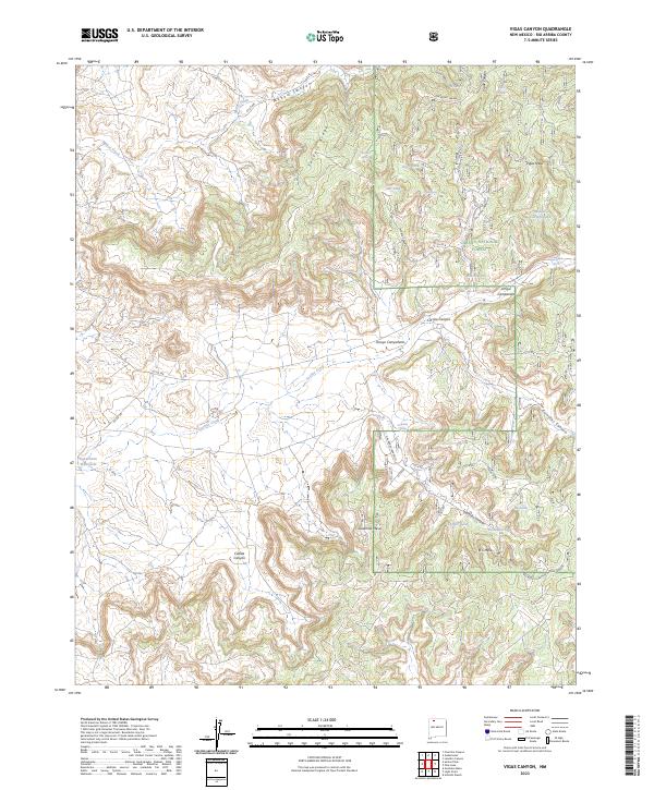
1963 Vigas Canyon
Rio Arriba County, NM
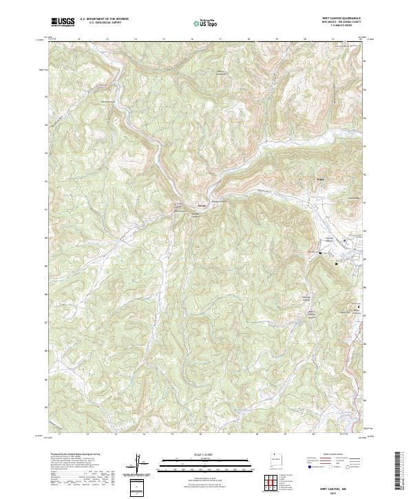
1963 Wirt Canyon
Rio Arriba County, NM
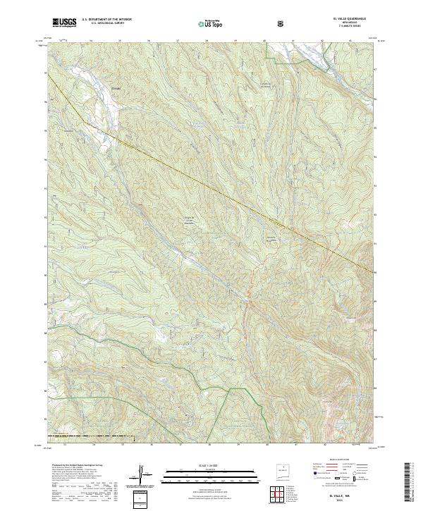
1964 El Valle
Rio Arriba County, NM

1980 Navajo Reservoir
Rio Arriba County, NM
1983 Apache Mesa
Rio Arriba County, NM
1983 Brazos Peak
Rio Arriba County, NM
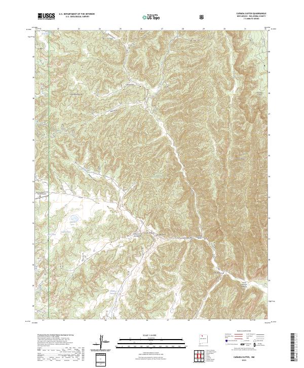
1983 Canada Ojitos
Rio Arriba County, NM
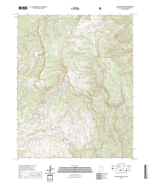
1983 Canjilon Mountain
Rio Arriba County, NM
1983 Cebolla
Rio Arriba County, NM
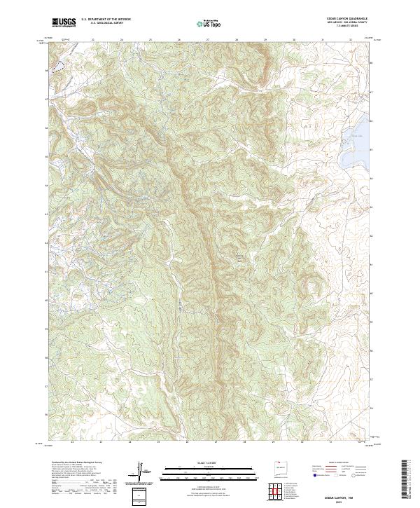
1983 Cedar Canyon
Rio Arriba County, NM
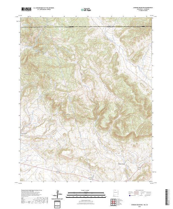
1983 Chromo Mountain
Rio Arriba County, NM
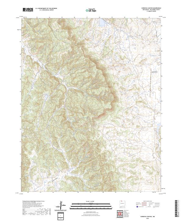
1983 Cordova Canyon
Rio Arriba County, NM

1983 East Gavilan Canyon
Rio Arriba County, NM

1983 El Vado
Rio Arriba County, NM

1983 French Mesa
Rio Arriba County, NM
1983 Heron Reservoir
Rio Arriba County, NM
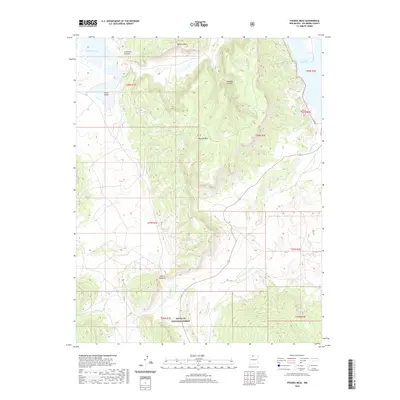
1983 Horse Lake
Rio Arriba County, NM
1983 Laguna Gurule
Rio Arriba County, NM
1983 Lagunitas Creek
Rio Arriba County, NM
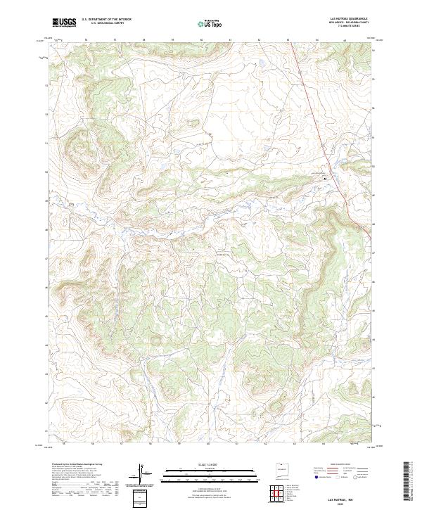
1983 Las Nutrias
Rio Arriba County, NM
1983 Llaves
Rio Arriba County, NM
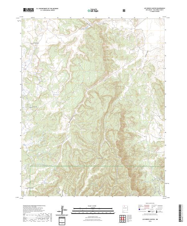
1983 Los Indios Canyon
Rio Arriba County, NM
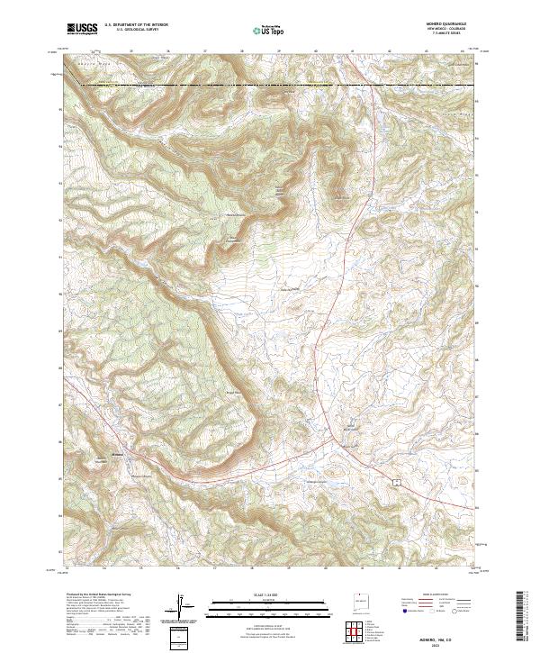
1983 Monero
Rio Arriba County, NM
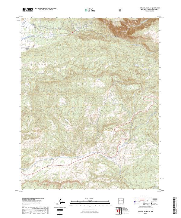
1983 Penasco Amarillo
Rio Arriba County, NM
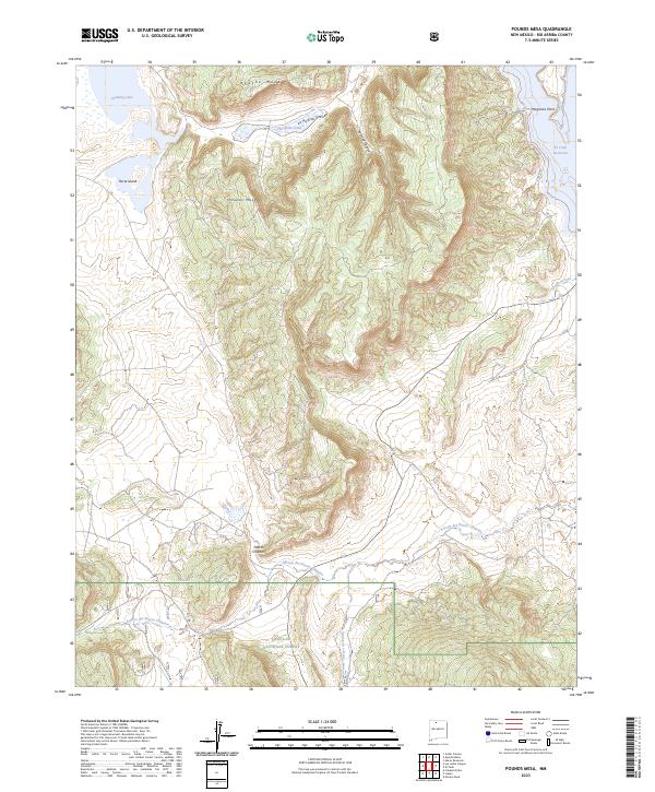
1983 Pounds Mesa
Rio Arriba County, NM
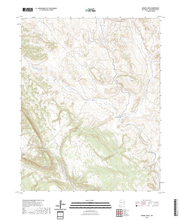
1983 Sawmill Mesa
Rio Arriba County, NM

1983 Toltec Mesa
Rio Arriba County, NM
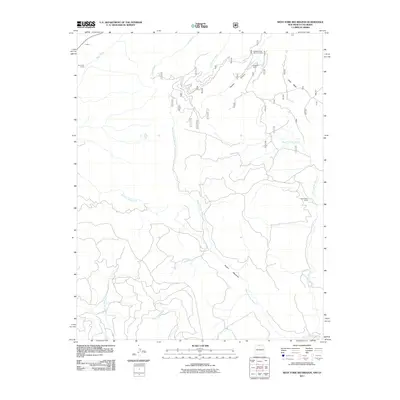
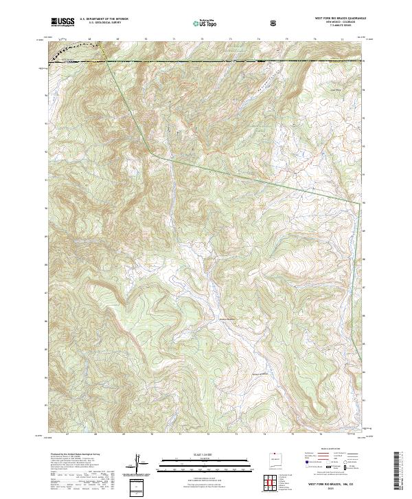
1983 West Fork Rio Brazos
Rio Arriba County, NM
1985 Crow Mesa East
Rio Arriba County, NM
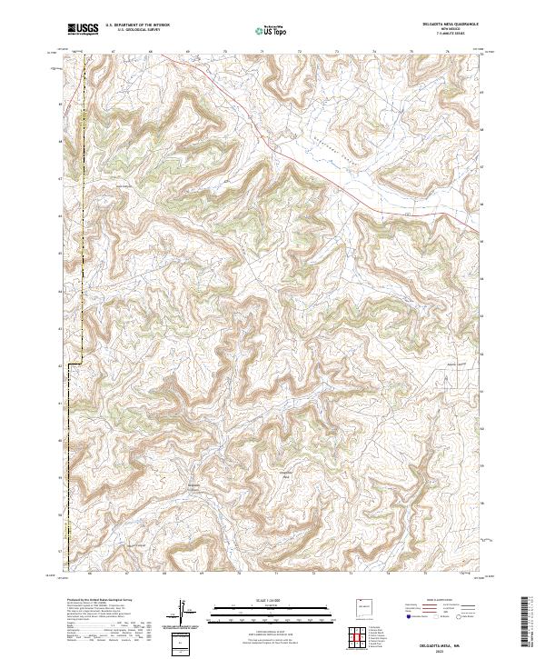
1985 Delgadita Mesa
Rio Arriba County, NM
1985 Gould Pass
Rio Arriba County, NM
1985 Smouse Mesa
Rio Arriba County, NM
1995 Alire
Rio Arriba County, NM
1995 Bancos Mesa
Rio Arriba County, NM
1995 Bighorn Peak
Rio Arriba County, NM
1995 Bixler Ranch
Rio Arriba County, NM
1995 Broke Off Mountain
Rio Arriba County, NM
1995 Burned Mountain
Rio Arriba County, NM
1995 Canjilon Mountain
Rio Arriba County, NM
1995 Canjilon SE
Rio Arriba County, NM
1995 Canones
Rio Arriba County, NM
1995 Canon Plaza
Rio Arriba County, NM
1995 Carracas Canyon
Rio Arriba County, NM
1995 Cebolla
Rio Arriba County, NM

1995 East Gavilan Canyon
Rio Arriba County, NM
1995 Echo Amphitheater
Rio Arriba County, NM

1995 El Valle
Rio Arriba County, NM
1995 Espinosa Ranch
Rio Arriba County, NM
1995 Ghost Ranch
Rio Arriba County, NM
1995 Gobernador
Rio Arriba County, NM
1995 Laguna Peak
Rio Arriba County, NM
1995 Lagunitas Creek
Rio Arriba County, NM
1995 Las Tablas
Rio Arriba County, NM
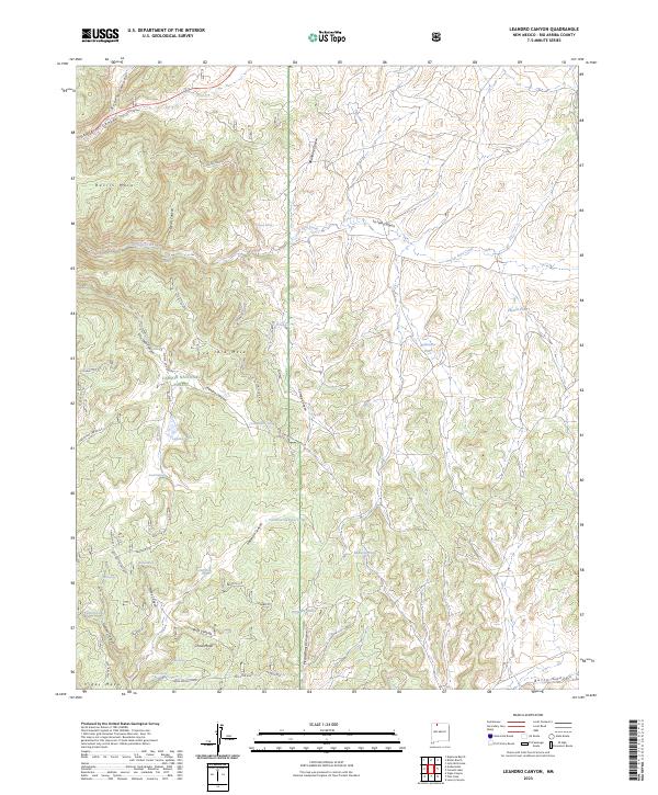
1995 Leandro Canyon
Rio Arriba County, NM
1995 Los Pinos
Rio Arriba County, NM
1995 Mogote Peak
Rio Arriba County, NM
1995 Mule Canyon
Rio Arriba County, NM
1995 Navajo Peak
Rio Arriba County, NM
1995 Pine Lake
Rio Arriba County, NM
1995 San Antonio Mountain
Rio Arriba County, NM

1995 Toltec Mesa
Rio Arriba County, NM
1995 Trampas
Rio Arriba County, NM
1995 Valle Grande Peak
Rio Arriba County, NM
1995 Vigas Canyon
Rio Arriba County, NM
1995 West Fork Rio Brazos
Rio Arriba County, NM
2002 Arroyo Del Agua
Rio Arriba County, NM
2002 Canada Ojitos
Rio Arriba County, NM
2002 Cerro Del Grant
Rio Arriba County, NM

2002 El Vado
Rio Arriba County, NM

2002 French Mesa
Rio Arriba County, NM

2002 Jarosa
Rio Arriba County, NM
2002 Laguna Gurule
Rio Arriba County, NM
2002 Llaves
Rio Arriba County, NM
2002 Los Indios Canyon
Rio Arriba County, NM

2002 Nacimiento Peak
Rio Arriba County, NM
2002 Polvadera Peak
Rio Arriba County, NM
2002 Pounds Mesa
Rio Arriba County, NM

2002 San Juan Pueblo
Rio Arriba County, NM
2002 Vallecitos
Rio Arriba County, NM
2010 Apache Mesa
Rio Arriba County, NM
2010 Bancos Mesa NW
Rio Arriba County, NM
2010 Billy Rice Canyon
Rio Arriba County, NM
2010 Brazos Peak
Rio Arriba County, NM
2010 Cement Lake
Rio Arriba County, NM
2010 Chromo Mountain
Rio Arriba County, NM
2010 Crow Mesa East
Rio Arriba County, NM
2010 Delgadita Mesa
Rio Arriba County, NM
2010 Fourmile Canyon
Rio Arriba County, NM
2010 Gomez Ranch
Rio Arriba County, NM
2010 Gonzales Mesa
Rio Arriba County, NM
2010 Gould Pass
Rio Arriba County, NM
2010 Horse Lake
Rio Arriba County, NM
2010 John Mills Lake
Rio Arriba County, NM
2010 Lapis Point
Rio Arriba County, NM
2010 Las Nutrias
Rio Arriba County, NM
2010 Leavry Canyon
Rio Arriba County, NM
2010 Ojito
Rio Arriba County, NM
2010 Otero Store
Rio Arriba County, NM
2010 Santos Peak
Rio Arriba County, NM
2010 Sawmill Mesa
Rio Arriba County, NM
2010 Schmitz Ranch
Rio Arriba County, NM
2010 Smouse Mesa
Rio Arriba County, NM
2010 Tafoya Canyon
Rio Arriba County, NM
2010 Wirt Canyon
Rio Arriba County, NM
2011 Alire
Rio Arriba County, NM
2011 Arroyo Del Agua
Rio Arriba County, NM
2011 Bancos Mesa
Rio Arriba County, NM
2011 Bighorn Peak
Rio Arriba County, NM
2011 Bixler Ranch
Rio Arriba County, NM
2011 Broke Off Mountain
Rio Arriba County, NM
2011 Burned Mountain
Rio Arriba County, NM
2011 Canada Ojitos
Rio Arriba County, NM
2011 Canjilon Mountain
Rio Arriba County, NM
2011 Canjilon SE
Rio Arriba County, NM
2011 Canones
Rio Arriba County, NM
2011 Canon Plaza
Rio Arriba County, NM
2011 Carracas Canyon
Rio Arriba County, NM
2011 Cebolla
Rio Arriba County, NM
2011 Cedar Canyon
Rio Arriba County, NM
2011 Cerro del Grant
Rio Arriba County, NM
2011 Cordova Canyon
Rio Arriba County, NM

2011 East Gavilan Canyon
Rio Arriba County, NM
2011 Echo Amphitheater
Rio Arriba County, NM

2011 El Vado
Rio Arriba County, NM
2011 El Valle
Rio Arriba County, NM
2011 Espinosa Ranch
Rio Arriba County, NM
2011 French Mesa
Rio Arriba County, NM
2011 Ghost Ranch
Rio Arriba County, NM
2011 Gobernador
Rio Arriba County, NM
2011 Heron Reservoir
Rio Arriba County, NM
2011 Jarosa
Rio Arriba County, NM
2011 Laguna Gurule
Rio Arriba County, NM
2011 Laguna Peak
Rio Arriba County, NM
2011 Lagunitas Creek
Rio Arriba County, NM
2011 Las Tablas
Rio Arriba County, NM
2011 Leandro Canyon
Rio Arriba County, NM
2011 Llaves
Rio Arriba County, NM
2011 Los Indios Canyon
Rio Arriba County, NM
2011 Los Pinos
Rio Arriba County, NM
2011 Mogote Peak
Rio Arriba County, NM
2011 Monero
Rio Arriba County, NM
2011 Mule Canyon
Rio Arriba County, NM

2011 Nacimiento Peak
Rio Arriba County, NM
2011 Navajo Peak
Rio Arriba County, NM
2011 Penasco Amarillo
Rio Arriba County, NM
2011 Pine Lake
Rio Arriba County, NM
2011 Polvadera Peak
Rio Arriba County, NM
2011 Pounds Mesa
Rio Arriba County, NM
2011 San Antonio Mountain
Rio Arriba County, NM

2011 San Juan Pueblo
Rio Arriba County, NM

2011 Toltec Mesa
Rio Arriba County, NM
2011 Trampas
Rio Arriba County, NM
2011 Vallecitos
Rio Arriba County, NM
2011 Valle Grande Peak
Rio Arriba County, NM
2011 Vigas Canyon
Rio Arriba County, NM
2011 West Fork Rio Brazos
Rio Arriba County, NM
2013 Alire
Rio Arriba County, NM
2013 Apache Mesa
Rio Arriba County, NM
2013 Arroyo Del Agua
Rio Arriba County, NM
2013 Bancos Mesa NW
Rio Arriba County, NM
2013 Bancos Mesa
Rio Arriba County, NM
2013 Bighorn Peak
Rio Arriba County, NM
2013 Billy Rice Canyon
Rio Arriba County, NM
2013 Bixler Ranch
Rio Arriba County, NM
2013 Brazos Peak
Rio Arriba County, NM
2013 Broke Off Mountain
Rio Arriba County, NM
2013 Burned Mountain
Rio Arriba County, NM
2013 Canada Ojitos
Rio Arriba County, NM
2013 Canjilon Mountain
Rio Arriba County, NM
2013 Canjilon SE
Rio Arriba County, NM
2013 Canones
Rio Arriba County, NM
2013 Canon Plaza
Rio Arriba County, NM

2013 Carracas Canyon
Rio Arriba County, NM
2013 Cebolla
Rio Arriba County, NM
2013 Cedar Canyon
Rio Arriba County, NM
2013 Cement Lake
Rio Arriba County, NM
2013 Cerro del Grant
Rio Arriba County, NM
2013 Chromo Mountain
Rio Arriba County, NM
2013 Cordova Canyon
Rio Arriba County, NM
2013 Crow Mesa East
Rio Arriba County, NM
2013 Delgadita Mesa
Rio Arriba County, NM

2013 East Gavilan Canyon
Rio Arriba County, NM
2013 Echo Amphitheater
Rio Arriba County, NM

2013 El Vado
Rio Arriba County, NM
2013 El Valle
Rio Arriba County, NM
2013 Espinosa Ranch
Rio Arriba County, NM
2013 Fourmile Canyon
Rio Arriba County, NM
2013 French Mesa
Rio Arriba County, NM
2013 Ghost Ranch
Rio Arriba County, NM
2013 Gobernador
Rio Arriba County, NM
2013 Gomez Ranch
Rio Arriba County, NM
2013 Gonzales Mesa
Rio Arriba County, NM
2013 Gould Pass
Rio Arriba County, NM
2013 Heron Reservoir
Rio Arriba County, NM
2013 Horse Lake
Rio Arriba County, NM
2013 Jarosa
Rio Arriba County, NM
2013 John Mills Lake
Rio Arriba County, NM
2013 Laguna Gurule
Rio Arriba County, NM
2013 Laguna Peak
Rio Arriba County, NM
2013 Lagunitas Creek
Rio Arriba County, NM
2013 Lapis Point
Rio Arriba County, NM
2013 Las Nutrias
Rio Arriba County, NM
2013 Las Tablas
Rio Arriba County, NM
2013 Leandro Canyon
Rio Arriba County, NM
2013 Leavry Canyon
Rio Arriba County, NM
2013 Llaves
Rio Arriba County, NM
2013 Los Indios Canyon
Rio Arriba County, NM
2013 Los Pinos
Rio Arriba County, NM
2013 Mogote Peak
Rio Arriba County, NM
2013 Monero
Rio Arriba County, NM
2013 Mule Canyon
Rio Arriba County, NM

2013 Nacimiento Peak
Rio Arriba County, NM
2013 Navajo Peak
Rio Arriba County, NM
2013 Ojito
Rio Arriba County, NM
2013 Otero Store
Rio Arriba County, NM
2013 Penasco Amarillo
Rio Arriba County, NM
2013 Pine Lake
Rio Arriba County, NM
2013 Polvadera Peak
Rio Arriba County, NM
2013 Pounds Mesa
Rio Arriba County, NM
2013 San Antonio Mountain
Rio Arriba County, NM

2013 San Juan Pueblo
Rio Arriba County, NM
2013 Santos Peak
Rio Arriba County, NM
2013 Sawmill Mesa
Rio Arriba County, NM
2013 Schmitz Ranch
Rio Arriba County, NM
2013 Smouse Mesa
Rio Arriba County, NM

2013 Tafoya Canyon
Rio Arriba County, NM

2013 Toltec Mesa
Rio Arriba County, NM
2013 Trampas
Rio Arriba County, NM
2013 Vallecitos
Rio Arriba County, NM
2013 Valle Grande Peak
Rio Arriba County, NM
2013 Vigas Canyon
Rio Arriba County, NM
2013 West Fork Rio Brazos
Rio Arriba County, NM
2013 Wirt Canyon
Rio Arriba County, NM
2017 Alire
Rio Arriba County, NM
2017 Apache Mesa
Rio Arriba County, NM
2017 Arroyo Del Agua
Rio Arriba County, NM
2017 Bancos Mesa NW
Rio Arriba County, NM
2017 Bancos Mesa
Rio Arriba County, NM
2017 Bighorn Peak
Rio Arriba County, NM
2017 Billy Rice Canyon
Rio Arriba County, NM
2017 Bixler Ranch
Rio Arriba County, NM
2017 Brazos Peak
Rio Arriba County, NM
2017 Broke Off Mountain
Rio Arriba County, NM
2017 Burned Mountain
Rio Arriba County, NM
2017 Canada Ojitos
Rio Arriba County, NM
2017 Canjilon Mountain
Rio Arriba County, NM
2017 Canjilon SE
Rio Arriba County, NM
2017 Canones
Rio Arriba County, NM
2017 Canon Plaza
Rio Arriba County, NM
2017 Carracas Canyon
Rio Arriba County, NM
2017 Cebolla
Rio Arriba County, NM
2017 Cedar Canyon
Rio Arriba County, NM
2017 Cement Lake
Rio Arriba County, NM
2017 Cerro del Grant
Rio Arriba County, NM
2017 Chromo Mountain
Rio Arriba County, NM
2017 Cordova Canyon
Rio Arriba County, NM
2017 Crow Mesa East
Rio Arriba County, NM
2017 Delgadita Mesa
Rio Arriba County, NM

2017 East Gavilan Canyon
Rio Arriba County, NM
2017 Echo Amphitheater
Rio Arriba County, NM

2017 El Vado
Rio Arriba County, NM
2017 El Valle
Rio Arriba County, NM
2017 Espinosa Ranch
Rio Arriba County, NM
2017 Fourmile Canyon
Rio Arriba County, NM
2017 French Mesa
Rio Arriba County, NM
2017 Ghost Ranch
Rio Arriba County, NM
2017 Gobernador
Rio Arriba County, NM
2017 Gomez Ranch
Rio Arriba County, NM
2017 Gonzales Mesa
Rio Arriba County, NM
2017 Gould Pass
Rio Arriba County, NM
2017 Heron Reservoir
Rio Arriba County, NM
2017 Horse Lake
Rio Arriba County, NM
2017 Jarosa
Rio Arriba County, NM
2017 John Mills Lake
Rio Arriba County, NM
2017 Laguna Gurule
Rio Arriba County, NM
2017 Laguna Peak
Rio Arriba County, NM
2017 Lagunitas Creek
Rio Arriba County, NM
2017 Lapis Point
Rio Arriba County, NM
2017 Las Nutrias
Rio Arriba County, NM
2017 Las Tablas
Rio Arriba County, NM
2017 Leandro Canyon
Rio Arriba County, NM
2017 Leavry Canyon
Rio Arriba County, NM
2017 Llaves
Rio Arriba County, NM
2017 Los Indios Canyon
Rio Arriba County, NM
2017 Los Pinos
Rio Arriba County, NM
2017 Mogote Peak
Rio Arriba County, NM
2017 Monero
Rio Arriba County, NM
2017 Mule Canyon
Rio Arriba County, NM

2017 Nacimiento Peak
Rio Arriba County, NM
2017 Navajo Peak
Rio Arriba County, NM
2017 Ojito
Rio Arriba County, NM
2017 Otero Store
Rio Arriba County, NM
2017 Penasco Amarillo
Rio Arriba County, NM
2017 Pine Lake
Rio Arriba County, NM
2017 Polvadera Peak
Rio Arriba County, NM
2017 Pounds Mesa
Rio Arriba County, NM
2017 San Antonio Mountain
Rio Arriba County, NM

2017 San Juan Pueblo
Rio Arriba County, NM
2017 Santos Peak
Rio Arriba County, NM
2017 Sawmill Mesa
Rio Arriba County, NM
2017 Schmitz Ranch
Rio Arriba County, NM
2017 Smouse Mesa
Rio Arriba County, NM
2017 Tafoya Canyon
Rio Arriba County, NM

2017 Toltec Mesa
Rio Arriba County, NM
2017 Trampas
Rio Arriba County, NM
2017 Vallecitos
Rio Arriba County, NM
2017 Valle Grande Peak
Rio Arriba County, NM
2017 Vigas Canyon
Rio Arriba County, NM
2017 West Fork Rio Brazos
Rio Arriba County, NM
2017 Wirt Canyon
Rio Arriba County, NM
2020 Alire
Rio Arriba County, NM
2020 Apache Mesa
Rio Arriba County, NM
2020 Arroyo Del Agua
Rio Arriba County, NM
2020 Bancos Mesa NW
Rio Arriba County, NM
2020 Bancos Mesa
Rio Arriba County, NM
2020 Bighorn Peak
Rio Arriba County, NM
2020 Billy Rice Canyon
Rio Arriba County, NM
2020 Bixler Ranch
Rio Arriba County, NM
2020 Brazos Peak
Rio Arriba County, NM
2020 Broke Off Mountain
Rio Arriba County, NM
2020 Burned Mountain
Rio Arriba County, NM
2020 Canada Ojitos
Rio Arriba County, NM
2020 Canjilon Mountain
Rio Arriba County, NM
2020 Canjilon SE
Rio Arriba County, NM
2020 Canones
Rio Arriba County, NM
2020 Canon Plaza
Rio Arriba County, NM
2020 Carracas Canyon
Rio Arriba County, NM
2020 Cebolla
Rio Arriba County, NM
2020 Cedar Canyon
Rio Arriba County, NM
2020 Cement Lake
Rio Arriba County, NM
2020 Cerro del Grant
Rio Arriba County, NM
2020 Chromo Mountain
Rio Arriba County, NM
2020 Cordova Canyon
Rio Arriba County, NM
2020 Crow Mesa East
Rio Arriba County, NM
2020 Delgadita Mesa
Rio Arriba County, NM

2020 East Gavilan Canyon
Rio Arriba County, NM
2020 Echo Amphitheater
Rio Arriba County, NM

2020 El Vado
Rio Arriba County, NM
2020 El Valle
Rio Arriba County, NM
2020 Espinosa Ranch
Rio Arriba County, NM
2020 Fourmile Canyon
Rio Arriba County, NM
2020 French Mesa
Rio Arriba County, NM
2020 Ghost Ranch
Rio Arriba County, NM
2020 Gobernador
Rio Arriba County, NM
2020 Gomez Ranch
Rio Arriba County, NM
2020 Gonzales Mesa
Rio Arriba County, NM
2020 Gould Pass
Rio Arriba County, NM
2020 Heron Reservoir
Rio Arriba County, NM
2020 Horse Lake
Rio Arriba County, NM
2020 Jarosa
Rio Arriba County, NM
2020 John Mills Lake
Rio Arriba County, NM
2020 Laguna Gurule
Rio Arriba County, NM
2020 Laguna Peak
Rio Arriba County, NM
2020 Lagunitas Creek
Rio Arriba County, NM
2020 Lapis Point
Rio Arriba County, NM
2020 Las Nutrias
Rio Arriba County, NM
2020 Las Tablas
Rio Arriba County, NM
2020 Leandro Canyon
Rio Arriba County, NM
2020 Leavry Canyon
Rio Arriba County, NM
2020 Llaves
Rio Arriba County, NM
2020 Los Indios Canyon
Rio Arriba County, NM
2020 Los Pinos
Rio Arriba County, NM
2020 Mogote Peak
Rio Arriba County, NM
2020 Monero
Rio Arriba County, NM
2020 Mule Canyon
Rio Arriba County, NM

2020 Nacimiento Peak
Rio Arriba County, NM
2020 Navajo Peak
Rio Arriba County, NM
2020 Ojito
Rio Arriba County, NM
2020 Otero Store
Rio Arriba County, NM
2020 Penasco Amarillo
Rio Arriba County, NM
2020 Pine Lake
Rio Arriba County, NM
2020 Polvadera Peak
Rio Arriba County, NM
2020 Pounds Mesa
Rio Arriba County, NM
2020 San Antonio Mountain
Rio Arriba County, NM

2020 San Juan Pueblo
Rio Arriba County, NM
2020 Santos Peak
Rio Arriba County, NM
2020 Sawmill Mesa
Rio Arriba County, NM
2020 Schmitz Ranch
Rio Arriba County, NM
2020 Smouse Mesa
Rio Arriba County, NM
2020 Tafoya Canyon
Rio Arriba County, NM

2020 Toltec Mesa
Rio Arriba County, NM
2020 Trampas
Rio Arriba County, NM
2020 Vallecitos
Rio Arriba County, NM
2020 Valle Grande Peak
Rio Arriba County, NM
2020 Vigas Canyon
Rio Arriba County, NM
2020 West Fork Rio Brazos
Rio Arriba County, NM
2020 Wirt Canyon
Rio Arriba County, NM
2023 Alire
Rio Arriba County, NM
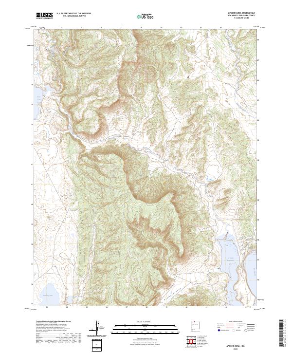
2023 Apache Mesa
Rio Arriba County, NM
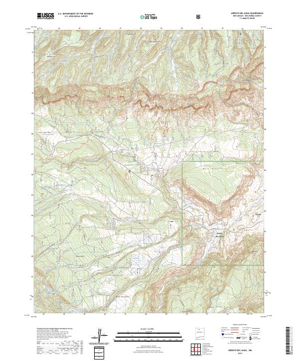
2023 Arroyo Del Agua
Rio Arriba County, NM
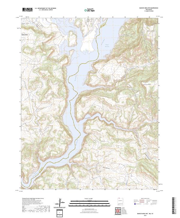
2023 Bancos Mesa NW
Rio Arriba County, NM
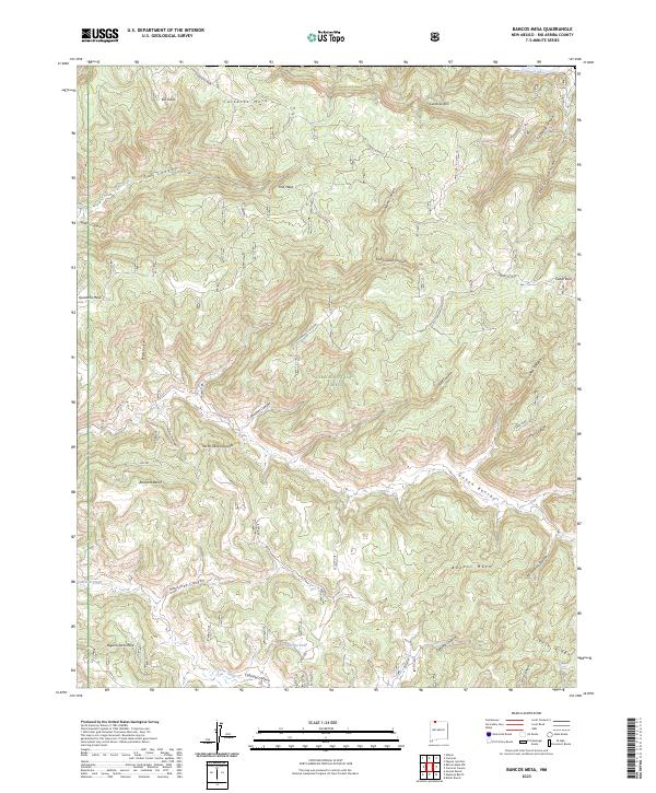
2023 Bancos Mesa
Rio Arriba County, NM
2023 Bighorn Peak
Rio Arriba County, NM
2023 Billy Rice Canyon
Rio Arriba County, NM
2023 Bixler Ranch
Rio Arriba County, NM
2023 Brazos Peak
Rio Arriba County, NM
2023 Broke Off Mountain
Rio Arriba County, NM
2023 Burned Mountain
Rio Arriba County, NM
2023 Canada Ojitos
Rio Arriba County, NM
2023 Canjilon Mountain
Rio Arriba County, NM
2023 Canjilon SE
Rio Arriba County, NM
2023 Canones
Rio Arriba County, NM
2023 Canon Plaza
Rio Arriba County, NM
2023 Carracas Canyon
Rio Arriba County, NM
2023 Cebolla
Rio Arriba County, NM
2023 Cedar Canyon
Rio Arriba County, NM
2023 Cement Lake
Rio Arriba County, NM
2023 Cerro del Grant
Rio Arriba County, NM
2023 Chromo Mountain
Rio Arriba County, NM
2023 Cordova Canyon
Rio Arriba County, NM
2023 Crow Mesa East
Rio Arriba County, NM
2023 Delgadita Mesa
Rio Arriba County, NM

2023 East Gavilan Canyon
Rio Arriba County, NM
2023 Echo Amphitheater
Rio Arriba County, NM

2023 El Vado
Rio Arriba County, NM
2023 El Valle
Rio Arriba County, NM
2023 Espinosa Ranch
Rio Arriba County, NM
2023 Fourmile Canyon
Rio Arriba County, NM
2023 French Mesa
Rio Arriba County, NM
2023 Ghost Ranch
Rio Arriba County, NM
2023 Gobernador
Rio Arriba County, NM
2023 Gomez Ranch
Rio Arriba County, NM
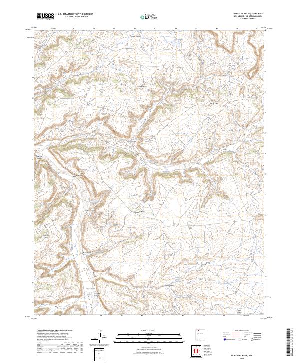
2023 Gonzales Mesa
Rio Arriba County, NM
2023 Gould Pass
Rio Arriba County, NM
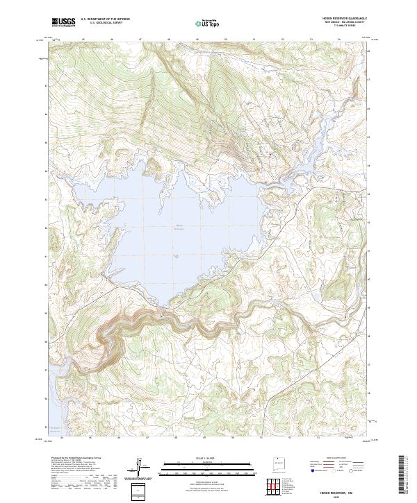
2023 Heron Reservoir
Rio Arriba County, NM

2023 Horse Lake
Rio Arriba County, NM
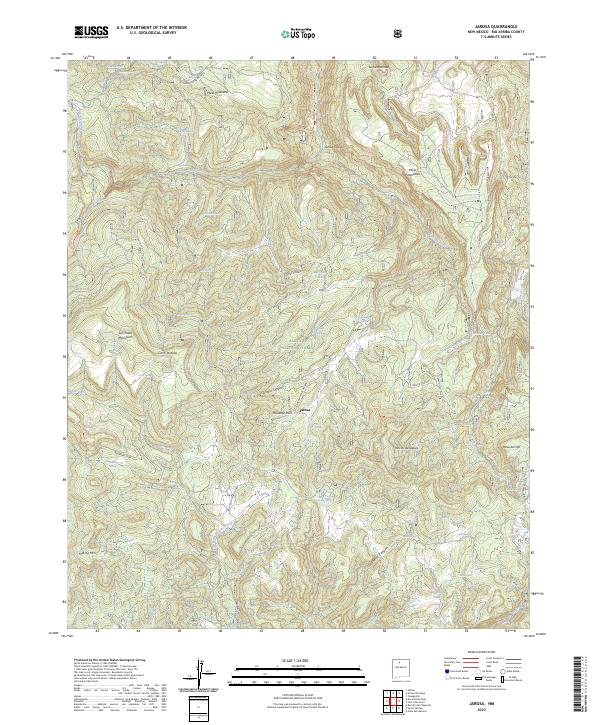
2023 Jarosa
Rio Arriba County, NM
2023 John Mills Lake
Rio Arriba County, NM

2023 Laguna Gurule
Rio Arriba County, NM
2023 Laguna Peak
Rio Arriba County, NM
2023 Lagunitas Creek
Rio Arriba County, NM
2023 Lapis Point
Rio Arriba County, NM
2023 Las Nutrias
Rio Arriba County, NM

2023 Las Tablas
Rio Arriba County, NM
2023 Leandro Canyon
Rio Arriba County, NM
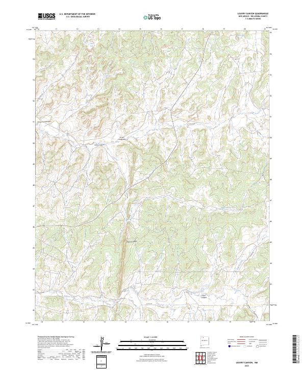
2023 Leavry Canyon
Rio Arriba County, NM
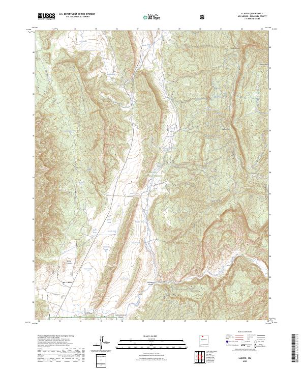
2023 Llaves
Rio Arriba County, NM
2023 Los Indios Canyon
Rio Arriba County, NM
2023 Los Pinos
Rio Arriba County, NM
2023 Mogote Peak
Rio Arriba County, NM
2023 Monero
Rio Arriba County, NM
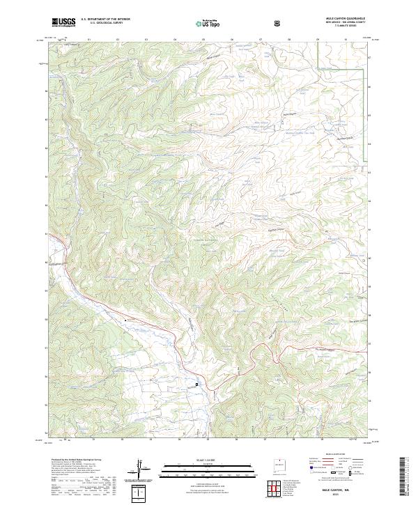
2023 Mule Canyon
Rio Arriba County, NM

2023 Nacimiento Peak
Rio Arriba County, NM
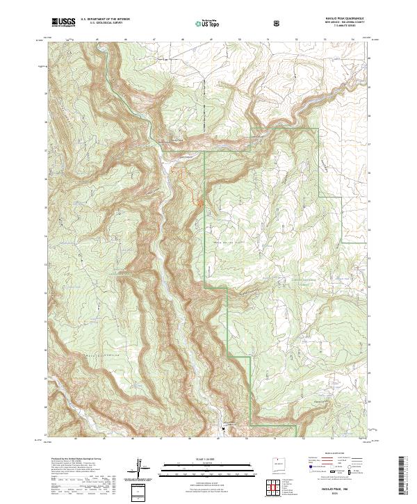
2023 Navajo Peak
Rio Arriba County, NM
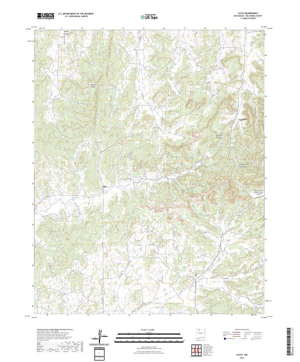
2023 Ojito
Rio Arriba County, NM
2023 Otero Store
Rio Arriba County, NM
2023 Penasco Amarillo
Rio Arriba County, NM
2023 Pine Lake
Rio Arriba County, NM
2023 Polvadera Peak
Rio Arriba County, NM
2023 Pounds Mesa
Rio Arriba County, NM
2023 San Antonio Mountain
Rio Arriba County, NM
2023 San Juan Pueblo
Rio Arriba County, NM
2023 Santos Peak
Rio Arriba County, NM
2023 Sawmill Mesa
Rio Arriba County, NM
2023 Schmitz Ranch
Rio Arriba County, NM
2023 Smouse Mesa
Rio Arriba County, NM
2023 Tafoya Canyon
Rio Arriba County, NM

2023 Toltec Mesa
Rio Arriba County, NM
2023 Trampas
Rio Arriba County, NM
2023 Vallecitos
Rio Arriba County, NM

2023 Valle Grande Peak
Rio Arriba County, NM
2023 Vigas Canyon
Rio Arriba County, NM
2023 West Fork Rio Brazos
Rio Arriba County, NM
2023 Wirt Canyon
Rio Arriba County, NM