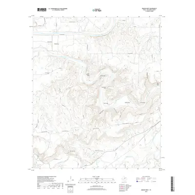
2019 Map of Brazos West
USGS Topo · Published 2019About this map
The Brazos River creates a winding series of deep oxbows and bends through this portion of Palo Pinto County, sculpting a landscape of high ridges and narrow valleys. This terrain is defined by dramatic river loops including John Hittson Bend, Chestnut Bend, and Whitley Bend, where the water has carved through the limestone and sandstone uplands. Small agricultural and residential clusters such as Village Bend and New Hope occupy the relatively level ground near the river's edge, while New Hope Cem serves as a quiet record of early family settlement in the area.
Find a feature on this map
52 named features on this map. Tap any name to fly to it.
Don’t see what you’re looking for? This feature index may not catch every label — zoom into the map to look around manually.
Map Details
Editions of this 2019 Brazos West Map
This is the sole edition of this map. No revisions or reprints were ever made.
Other maps of this area

1891 · Palo Pinto
USGS Topo · 1:125,000

1918 · Palo Pinto
USGS Topo · 1:125,000

1925 · Palo Pinto 4-b
USGS Topo · 1:48,000

1927 · Pickwick
USGS Topo · 1:62,500

1927 · Mineral Wells
USGS Topo · 1:62,500

1931 · Santo
USGS Topo · 1:62,500

1954 · Abilene
USGS Topo · 1:250,000

1958 · Abilene
USGS Topo · 1:250,000

1958 · Palo Pinto
USGS Topo · 1:62,500
1959 · Mineral Wells
USGS Topo · 1:62,500