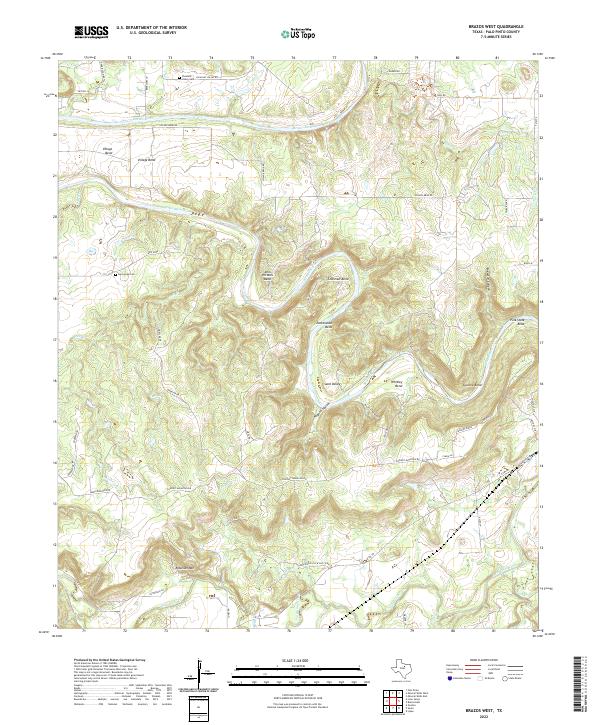
2022 Map of Brazos West
USGS Topo · Published 2022About this map
The Brazos River carves a winding, serpentine path through this portion of Palo Pinto County, defining the local geography through a series of dramatic meanders including John Hittson Bend, Edmondson Bend, and Whitley Bend. The terrain is characterized by significant relief, rising from the riverbanks to prominent heights like Robinson Mtn and the ridges along Chesnut Mountain Rd. This landscape supports small settlements such as New Hope and Sand Valley, where local history is anchored by the New Hope Cem and Pleasant Valley Cem. The southern portion of the quadrangle is drained by Palo Pinto Creek and its tributaries, including Worser Cr and Buck Cr. Industrial activity is noted by the presence of the Kirpatrick Oil & Gas Co Rd, reflecting the region's intersection of ranching landscape and energy resources.
Find a feature on this map
56 named features on this map. Tap any name to fly to it.
Don’t see what you’re looking for? This feature index may not catch every label — zoom into the map to look around manually.
Map Details
Editions of this 2022 Brazos West Map
This is the sole edition of this map. No revisions or reprints were ever made.
Other maps of this area

1891 · Palo Pinto
USGS Topo · 1:125,000

1918 · Palo Pinto
USGS Topo · 1:125,000

1925 · Palo Pinto 4-b
USGS Topo · 1:48,000

1927 · Pickwick
USGS Topo · 1:62,500

1927 · Mineral Wells
USGS Topo · 1:62,500

1931 · Santo
USGS Topo · 1:62,500

1954 · Abilene
USGS Topo · 1:250,000

1958 · Abilene
USGS Topo · 1:250,000

1958 · Palo Pinto
USGS Topo · 1:62,500
1959 · Mineral Wells
USGS Topo · 1:62,500