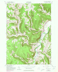
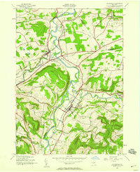
1943 Map of Breakabeen
USGS Topo · Published 1980About this map
Schoharie Creek dictates the geography of this Catskills-border landscape, winding past Boucks Island and the cliffs of Walhalla Rocks. The valley floor supports agricultural settlements like Breakabeen and Fultonham, while the surrounding uplands are dominated by extensive State Reforestation Areas. This pattern of high-altitude reforestation suggests a mid-century shift away from marginal upland farming toward conservation and timber management.
Find a feature on this map
37 named features on this map. Tap any name to fly to it.
Don’t see what you’re looking for? This feature index may not catch every label — zoom into the map to look around manually.
Map Details
Editions of this 1943 Breakabeen Map
5 editions found
Other maps of this area

1898 · Schoharie
USGS Topo · 1:62,500

1900 · Schoharie
USGS Topo · 1:62,500

1900 · Schoharie
USGS Topo · 1:31,680

1901 · Gilboa
USGS Topo · 1:62,500

1903 · Gilboa
USGS Topo · 1:62,500

1904 · Richmondville
USGS Topo · 1:62,500

1904 · Hobart
USGS Topo · 1:62,500

1943 · Cobleskill
USGS Topo · 1:24,000

1943 · Breakabeen
USGS Topo · 1:24,000
1943 · Schoharie
USGS Topo · 1:24,000