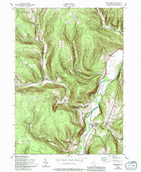
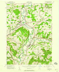
1943 Map of Breakabeen
USGS Topo · Published 1994About this map
Schoharie Creek dominates this Schoharie County landscape, carving a deep valley that dictates the layout of the region's mid-century rural settlements. The topography is defined by high ridges like Toe-path Mountain and Fulton Hill, which hem in the small communities of West Fulton, Fultonham, and Vintonton. These hamlets are connected by roads that hug the narrow valley floors, illustrating a classic Catskill-adjacent settlement pattern where agricultural and social life concentrated near water sources such as Panther Creek and Line Kill.
Find a feature on this map
32 named features on this map. Tap any name to fly to it.
Don’t see what you’re looking for? This feature index may not catch every label — zoom into the map to look around manually.
Map Details
Editions of this 1943 Breakabeen Map
5 editions found
Other maps of this area

1898 · Schoharie
USGS Topo · 1:62,500

1900 · Schoharie
USGS Topo · 1:62,500

1900 · Schoharie
USGS Topo · 1:31,680

1901 · Gilboa
USGS Topo · 1:62,500

1903 · Gilboa
USGS Topo · 1:62,500

1904 · Richmondville
USGS Topo · 1:62,500

1904 · Hobart
USGS Topo · 1:62,500

1943 · Cobleskill
USGS Topo · 1:24,000

1943 · Breakabeen
USGS Topo · 1:24,000
1943 · Schoharie
USGS Topo · 1:24,000