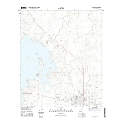
2016 Map of Breckenridge
USGS Topo · Published 2016About this map
Breckenridge serves as the focal point for this 2016 survey of the Texas Rolling Plains, where the urban grid meets the sprawling waters of the Hubbard Cr Reservoir. The landscape is defined by the drainage systems of Hubbard Creek and Gunsolus Creek, which carve through a series of isolated elevations including Gore Mtn, Coal Mtn, and Donkey Mtn. These peaks provide prominent landmarks in an area otherwise characterized by agricultural roads and rural developments like Cactus Cove. Local heritage is anchored by the Picketville Cem, a vital site for genealogists tracing early settlement in Stephens County. The map captures the modern balance between industrial infrastructure near the city and the recreational shoreline of the reservoir, including smaller water bodies such as Robbins Lake and the Twin Lakes further inland.
Find a feature on this map
105 named features on this map. Tap any name to fly to it.
Don’t see what you’re looking for? This feature index may not catch every label — zoom into the map to look around manually.
Map Details
Editions of this 2016 Breckenridge Map
This is the sole edition of this map. No revisions or reprints were ever made.
Other maps of this area

1890 · Breckenridge
USGS Topo · 1:125,000

1892 · Albany
USGS Topo · 1:125,000

1893 · Albany
USGS Topo · 1:125,000

1954 · Abilene
USGS Topo · 1:250,000

1958 · Abilene
USGS Topo · 1:250,000

1958 · Breckenridge
USGS Topo · 1:24,000

1958 · Edwards Branch
USGS Topo · 1:24,000

1961 · Buck Mountain
USGS Topo · 1:24,000

1961 · Eolian
USGS Topo · 1:24,000

1965 · Lusk
USGS Topo · 1:24,000