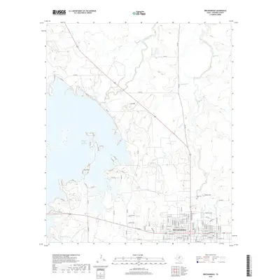
2019 Map of Breckenridge
USGS Topo · Published 2019About this map
Breckenridge serves as the focal point of this North Texas landscape, situated at a major convergence of regional highways and local routes in Stephens County. The town layout is clearly defined by a dense grid of streets, while the surrounding topography is shaped by the expansive western shoreline of the Hubbard Creek Reservoir. This massive water body, alongside smaller features like Twin Lakes and Robbins Lake, illustrates the critical role of water management in this part of the state.
Find a feature on this map
102 named features on this map. Tap any name to fly to it.
Don’t see what you’re looking for? This feature index may not catch every label — zoom into the map to look around manually.
Map Details
Editions of this 2019 Breckenridge Map
This is the sole edition of this map. No revisions or reprints were ever made.
Other maps of this area

1890 · Breckenridge
USGS Topo · 1:125,000

1892 · Albany
USGS Topo · 1:125,000

1893 · Albany
USGS Topo · 1:125,000

1954 · Abilene
USGS Topo · 1:250,000

1958 · Abilene
USGS Topo · 1:250,000

1958 · Breckenridge
USGS Topo · 1:24,000

1958 · Edwards Branch
USGS Topo · 1:24,000

1961 · Buck Mountain
USGS Topo · 1:24,000

1961 · Eolian
USGS Topo · 1:24,000

1965 · Lusk
USGS Topo · 1:24,000