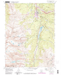
1970 Map of Breckenridge
USGS Topo · Published 1988About this map
Breckenridge sits at the heart of this high-alpine landscape, where the legacies of the mining era meet the early development of the Breckenridge Ski Area. The mapping shows a complex industrial history along French Gulch, notably the French Dredge and the Wellington Mine, indicating how the search for gold and silver reshaped the valley floor. To the west, the formidable peaks of the Tenmile Range rise sharply, including numbered summits from Peak 6 through Peak 10, while the southern reaches are dominated by Quandary Peak near the Continental Divide.
Find a feature on this map
66 named features on this map. Tap any name to fly to it.
Don’t see what you’re looking for? This feature index may not catch every label — zoom into the map to look around manually.
Map Details
Editions of this 1970 Breckenridge Map
3 editions found
Other maps of this area

1889 · Leadville
USGS Topo · 1:125,000

1891 · Leadville
USGS Topo · 1:125,000

1924 · Montezuma
USGS Topo · 1:62,500

1926 · Montezuma
USGS Topo · 1:62,500

1929 · Dillon
USGS Topo · 1:62,500

1933 · Montezuma
USGS Topo · 1:62,500

1934 · Climax
USGS Topo · 1:48,000

1934 · Dillon
USGS Topo · 1:62,500

1937 · Como
USGS Topo · 1:62,500

1938 · Mt. Lincoln
USGS Topo · 1:48,000