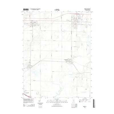
2015 Map of Breese
USGS Topo · Published 2015About this map
Breese and its neighboring Clinton County villages anchor this modern survey of Illinois agricultural land. The map reveals a tight-knit cluster of settlements including Germantown, Aviston, Albers, and Damiansville, each organized around a distinct street grid and centered on its parish church and cemetery. The landscape is defined by the meandering course of Shoal Creek and its various tributaries like Grassy Br and Bull Br, which carve through the otherwise orderly township and range system.
Find a feature on this map
115 named features on this map. Tap any name to fly to it.
Don’t see what you’re looking for? This feature index may not catch every label — zoom into the map to look around manually.
Map Details
Editions of this 2015 Breese Map
This is the sole edition of this map. No revisions or reprints were ever made.
Other maps of this area

1906 · Breese
USGS Topo · 1:62,500

1907 · Breese
USGS Topo · 1:62,500

1910 · Carlyle
USGS Topo · 1:62,500

1910 · Okawville
USGS Topo · 1:62,500

1931 · Hoyleton
USGS Topo · 1:48,000

1932 · Nashville
USGS Topo · 1:62,500

1936 · Nashville
USGS Topo · 1:62,500

1940 · Okawville
USGS Topo · 1:62,500

1948 · Carlyle
USGS Topo · 1:62,500
1957 · Highland
USGS Topo · 1:24,000