
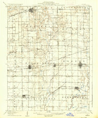
1907 Map of Breese
USGS Topo · Published 1907About this map
The agrarian plains of southern Illinois at the start of the 20th century are defined by an expansive grid of rural schools and the steel lines of four major railroads. Settlement clusters such as Highland, Trenton, and Breese anchor the landscape, while smaller locales like Sebastopol and St Rose serve the outlying farming townships. The map illustrates a high density of one-room schools, including Linden School, Forrest School, and Frey School, which were the social hearts of these local districts before mid-century consolidation.
Find a feature on this map
56 named features on this map. Tap any name to fly to it.
Don’t see what you’re looking for? This feature index may not catch every label — zoom into the map to look around manually.
Map Details
Editions of this 1907 Breese Map
2 editions found
Other maps of this area

1906 · Breese
USGS Topo · 1:62,500

1907 · Belleville
USGS Topo · 1:62,500

1910 · Carlyle
USGS Topo · 1:62,500

1910 · Okawville
USGS Topo · 1:62,500

1912 · New Athens
USGS Topo · 1:62,500

1927 · Edwardsville
USGS Topo · 1:62,500

1931 · Hoyleton
USGS Topo · 1:48,000

1932 · Edwardsville
USGS Topo · 1:62,500

1932 · Greenville
USGS Topo · 1:62,500

1932 · Nashville
USGS Topo · 1:62,500