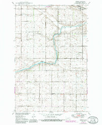
1948 Map of Bremen
USGS Topo · Published 1986About this map
James River meanders through the central plains of Wells County, shaping a landscape defined by the agricultural townships of Hamburg, Bremen, and Germantown. The settlement of Bremen serves as the primary rail point along the Burlington Northern line in the northeast, reflecting the importance of grain transport in this era. This 1948 survey, updated in the mid-1980s, captures a network of rural education and faith, evidenced by School No 1, School No 2, and School No 3, alongside St Josephs Ch. To the north, the National Waterfowl Production Area indicates a shift toward conservation and land management. The map provides a precise view of the section lines and township boundaries that organized the North Dakota prairie, including the German Baptist Cem which serves as a vital marker for local genealogical research.
Find a feature on this map
17 named features on this map. Tap any name to fly to it.
Don’t see what you’re looking for? This feature index may not catch every label — zoom into the map to look around manually.
Map Details
Editions of this 1948 Bremen Map
2 editions found
Other maps of this area

1932 · Flora
USGS Topo · 1:62,500

1943 · Maddock
USGS Topo · 1:62,500

1945 · Maddock
USGS Topo · 1:62,500

1948 · Cathay
USGS Topo · 1:62,500

1948 · Fessenden
USGS Topo · 1:62,500

1948 · Bremen
USGS Topo · 1:24,000

1949 · Bremen
USGS Topo · 1:24,000

1949 · Cathay
USGS Topo · 1:24,000

1949 · Cathay SE
USGS Topo · 1:24,000

1949 · Fessenden East
USGS Topo · 1:24,000