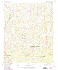
1973 Map of Brentwood
USGS Topo · Published 1983About this map
Gaylor Mountain and the high ridges of the Ozark National Forest dominate this landscape during the early 1970s. The Burlington Northern railroad winds through the valley of the West Fork White River, passing the small settlement of Brentwood and the quiet grounds of Parks Cem. Further south, the terrain rises toward Mount Gaylor, where Our Lady of the Ozarks Shrine and a Lookout Tower overlook the rugged topography of the Washington and Crawford County line.
Find a feature on this map
46 named features on this map. Tap any name to fly to it.
Don’t see what you’re looking for? This feature index may not catch every label — zoom into the map to look around manually.
Map Details
Editions of this 1973 Brentwood Map
3 editions found
Other maps of this area

1879 · Cravens
USGS Topo · 1:62,500

1887 · Watalula
USGS Topo · 1:62,500

1898 · Winslow #4
USGS Topo · 1:62,500

1898 · Winslow
USGS Topo · 1:125,000

1901 · Winslow
USGS Topo · 1:125,000

1939 · Watalula
USGS Topo · 1:62,500

1943 · St. Paul
USGS Topo · 1:62,500

1946 · St. Paul
USGS Topo · 1:62,500

1946 · Fort Smith
USGS Topo · 1:250,000

1956 · Russellville
USGS Topo · 1:250,000