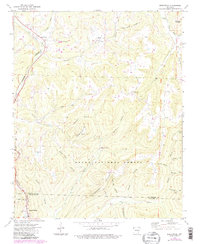
1973 Map of Brentwood
USGS Topo · Published 1983About this map
The Burlington Northern railroad corridor dictates the settlement pattern in this 1973 survey of the Arkansas highlands, winding through the valley of the West Fork toward the village of Brentwood. This terrain is defined by a series of steep ridges and deeply incised hollows, including Paschal Hollow and Purdue Hollow, which forced early roads and communities into narrow passages. Deep in the Ozark National Forest, the map records numerous small cemeteries like Koyle Cem and Terry Cem, alongside isolated landmarks such as Black Oak Ch and the Our Lady of the Ozarks Shrine. The presence of several family-named locations such as Lafe Evans Hol and Barnard Hol suggests a landscape shaped by generational homesteading, while modern infrastructure is represented by the Henderson Pipeline cutting across the Crawford County line near Mount Gaylor.
Find a feature on this map
48 named features on this map. Tap any name to fly to it.
Don’t see what you’re looking for? This feature index may not catch every label — zoom into the map to look around manually.
Map Details
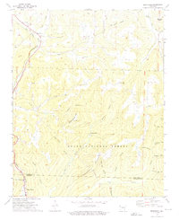
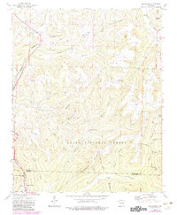
Editions of this 1973 Brentwood Map
3 editions found
Other maps of this area

1879 · Cravens
USGS Topo · 1:62,500

1887 · Watalula
USGS Topo · 1:62,500

1898 · Winslow #4
USGS Topo · 1:62,500

1898 · Winslow
USGS Topo · 1:125,000

1901 · Winslow
USGS Topo · 1:125,000

1939 · Watalula
USGS Topo · 1:62,500

1943 · St. Paul
USGS Topo · 1:62,500

1946 · St. Paul
USGS Topo · 1:62,500

1946 · Fort Smith
USGS Topo · 1:250,000

1956 · Russellville
USGS Topo · 1:250,000