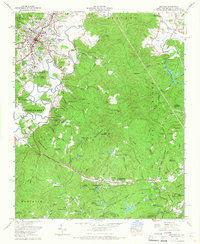
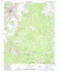
1965 Map of Brevard
USGS Topo · Published 1967About this map
Brevard and its surrounding mountain gaps are documented here in the mid-1960s, a period when the region's character as a mountain retreat and educational hub was firmly established. The campus of Brevard College anchors the town, while the Southern railroad line follows the course of the French Broad River through the valley. This survey reveals a landscape where residential expansion at Broadview Estates and Forest Hills met the edges of the Pisgah National Forest. The map tracks the shift from traditional rural landmarks like the Rosenwald School and numerous family burying grounds, such as Glazener Cem and Round Top Cem, to a mid-century recreation economy. This is evidenced by the density of organized camps including Camp Carolina, Rockbrook Camp, and Camp Deerwoode, many situated near topographic landmarks like Dunns Rock and the Little River.
Find a feature on this map
90 named features on this map. Tap any name to fly to it.
Don’t see what you’re looking for? This feature index may not catch every label — zoom into the map to look around manually.
Map Details
Editions of this 1965 Brevard Map
5 editions found
Other maps of this area

1905 · Pisgah
USGS Topo · 1:125,000

1906 · Pisgah
USGS Topo · 1:125,000

1935 · Brevard
USGS Topo · 1:24,000

1935 · Eastatoe Gap
USGS Topo · 1:24,000

1935 · Standingstone Mtn.
USGS Topo · 1:24,000

1935 · Horse Shoe
USGS Topo · 1:24,000

1935 · Rosman
USGS Topo · 1:24,000

1935 · Table Rock
USGS Topo · 1:24,000

1935 · Shining Rock
USGS Topo · 1:24,000

1935 · Pisgah Forest
USGS Topo · 1:24,000