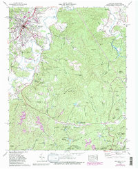
1965 Map of Brevard
USGS Topo · Published 1991About this map
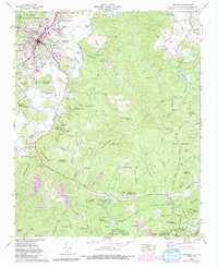
The French Broad River flows through a landscape defined by the growing town of Brevard and the extensive reaching of the Pisgah National Forest. This 1965 survey, updated with 1988 data, captures the community expansion seen in Broadview Estates and Forest Hills alongside long-standing local landmarks like Brevard College and the Rosenwald School. The terrain is marked by significant peaks such as Sugar Loaf Mountain and Slick Rock Mountain, while the valley floors are dotted with numerous small family and community cemeteries, including the Glazener Cem and Round Top Cem. The eastern portion of the map highlights the recreational and summer camp culture of the region, featuring Camp Carolina, Camp Deerwoode, and Eagle Nest Camp, alongside the hydroelectric and recreational waters of Cascade Lake and the Little River. This map provides a detailed view of the Tennessee Valley Divide as it crosses into the high country of the North Carolina and South Carolina borderlands.
Find a feature on this map
75 named features on this map. Tap any name to fly to it.
Don’t see what you’re looking for? This feature index may not catch every label — zoom into the map to look around manually.
Map Details
Editions of this 1965 Brevard Map
5 editions found
Other maps of this area

1905 · Pisgah
USGS Topo · 1:125,000

1906 · Pisgah
USGS Topo · 1:125,000

1935 · Brevard
USGS Topo · 1:24,000

1935 · Eastatoe Gap
USGS Topo · 1:24,000

1935 · Standingstone Mtn.
USGS Topo · 1:24,000

1935 · Horse Shoe
USGS Topo · 1:24,000

1935 · Rosman
USGS Topo · 1:24,000

1935 · Table Rock
USGS Topo · 1:24,000

1935 · Shining Rock
USGS Topo · 1:24,000

1935 · Pisgah Forest
USGS Topo · 1:24,000