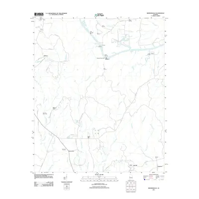
2011 Map of Brewersville
USGS Topo · Published 2011About this map
The Tombigbee River meanders through this Sumter County landscape, defining the northern geography with distinctive riverine features like Cold Springs Bar and Buzzard Roost Bluff. Small rural settlements and family landmarks anchor the upland areas, including Brewersville, Zion Hill, and Moore Town. The map reveals a high density of small cemeteries such as Brown Cemetery, Neal Cemetery, and Saint Matthew Cemetery, which serve as vital touchstones for genealogical research in this part of Alabama.
Find a feature on this map
61 named features on this map. Tap any name to fly to it.
Don’t see what you’re looking for? This feature index may not catch every label — zoom into the map to look around manually.
Map Details
Editions of this 2011 Brewersville Map
This is the sole edition of this map. No revisions or reprints were ever made.
Other maps of this area

1929 · Epes
USGS Topo · 1:48,000

1932 · Epes
USGS Topo · 1:62,500

1947 · Forkland
USGS Topo · 1:24,000

1948 · Mc Dowell
USGS Topo · 1:24,000

1949 · Mc Dowell
USGS Topo · 1:24,000

1949 · Forkland
USGS Topo · 1:24,000

1953 · Montgomery
USGS Topo · 1:250,000

1953 · Meridian
USGS Topo · 1:250,000

1956 · Montgomery
USGS Topo · 1:250,000

1957 · Meridian
USGS Topo · 1:250,000