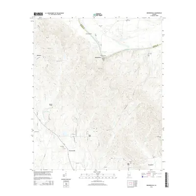
2014 Map of Brewersville
USGS Topo · Published 2014About this map
The Tombigbee River snakes along the boundary between Sumter and Greene Counties, defining the northern landscape with features like Buzzard Roost Bluff and the river deposits at Cold Springs Bar. This 2014 survey documents the enduring rural structure of the region, where historical navigation points like Old Bluffport and Bluff Port Bar contrast with inland settlements such as Brewersville and Zion Hill. The map is particularly useful for genealogical research, identifying numerous family and community burial grounds including Saint Matthew Cem, Phares Cem, and Nebo Cem. Numerous creeks and branches, including Coatopa Cr and Mill Creek, drain the undulating terrain, while modern landmarks like Katherine Allison Lake and several residential developments near Moore Town show the area's contemporary evolution alongside its traditional agricultural and river-based roots.
Find a feature on this map
57 named features on this map. Tap any name to fly to it.
Don’t see what you’re looking for? This feature index may not catch every label — zoom into the map to look around manually.
Map Details
Editions of this 2014 Brewersville Map
This is the sole edition of this map. No revisions or reprints were ever made.
Other maps of this area

1929 · Epes
USGS Topo · 1:48,000

1932 · Epes
USGS Topo · 1:62,500

1947 · Forkland
USGS Topo · 1:24,000

1948 · Mc Dowell
USGS Topo · 1:24,000

1949 · Mc Dowell
USGS Topo · 1:24,000

1949 · Forkland
USGS Topo · 1:24,000

1953 · Montgomery
USGS Topo · 1:250,000

1953 · Meridian
USGS Topo · 1:250,000

1956 · Montgomery
USGS Topo · 1:250,000

1957 · Meridian
USGS Topo · 1:250,000