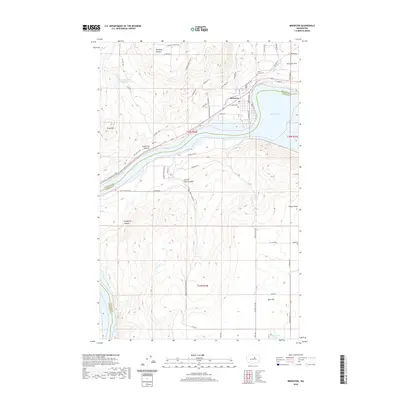
2020 Map of Brewster
USGS Topo · Published 2020About this map
The confluence of the Okanogan and Columbia rivers shapes the landscape here, where Brewster sits on the northern bank of Lake Pateros. This modern survey illustrates the intensive agricultural use of the surrounding benches, particularly at Brewster Flat and near the residential development of Harmony Heights. The map reveals a complex irrigation and water management network necessitated by the arid climate, including Indian Dan Canyon Reservoir and McKie Pond, which support the orchards and farms dotting the terrain.
Find a feature on this map
60 named features on this map. Tap any name to fly to it.
Don’t see what you’re looking for? This feature index may not catch every label — zoom into the map to look around manually.
Map Details
Editions of this 2020 Brewster Map
This is the sole edition of this map. No revisions or reprints were ever made.
Other maps of this area

1905 · Okanogan
USGS Topo · 1:125,000

1953 · Ritzville
USGS Topo · 1:250,000

1954 · Okanogan
USGS Topo · 1:250,000

1957 · Bridgeport
USGS Topo · 1:62,500

1957 · Brewster
USGS Topo · 1:62,500

1958 · Okanogan
USGS Topo · 1:250,000

1959 · Ritzville
USGS Topo · 1:250,000

1965 · Ritzville
USGS Topo · 1:250,000

1968 · Chief Joseph Dam
USGS Topo · 1:24,000

1968 · Wells Dam
USGS Topo · 1:24,000