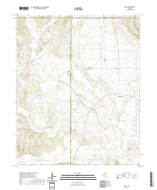
2022 Map of Brice
USGS Topo · Published 2022About this map
Palo Duro Canyon carves through the southwestern corner of this West Texas landscape, where the Prairie Dog Town Fork Red River flows across a wide, braided basin. This 2022 survey captures a rural ranching and farming region at the junction of Briscoe, Donley, and Hall counties. The small settlements of Brice and South Brice anchor the eastern side of the quadrangle, connected by a network of county roads such as Co RD 3 and Co RD 5. Numerous ephemeral watercourses, including Mulberry Cr, Bitter Cr, and Brushy Cr, dissect the upland plains, leading toward the dramatic breaks of the canyon country. Small bodies of water like Timber Lake and Sink Lake dot the western reaches, marking the distinct topography of the Llano Estacado. The map provides a precise layout of property boundaries and local transit routes as they exist in the modern era.
Find a feature on this map
28 named features on this map. Tap any name to fly to it.
Don’t see what you’re looking for? This feature index may not catch every label — zoom into the map to look around manually.
Map Details
Editions of this 2022 Brice Map
This is the sole edition of this map. No revisions or reprints were ever made.
Other maps of this area

1954 · Plainview
USGS Topo · 1:250,000

1958 · Plainview
USGS Topo · 1:250,000

1960 · Indian Peak
USGS Topo · 1:62,500

1960 · Brice
USGS Topo · 1:62,500

1963 · Clarendon SE
USGS Topo · 1:24,000

1963 · Tate Arroyo
USGS Topo · 1:24,000

1963 · Clarendon SW
USGS Topo · 1:24,000

1976 · Brice SE
USGS Topo · 1:24,000

1976 · Brice NW
USGS Topo · 1:24,000
1976 · Indian Peak NE
USGS Topo · 1:24,000