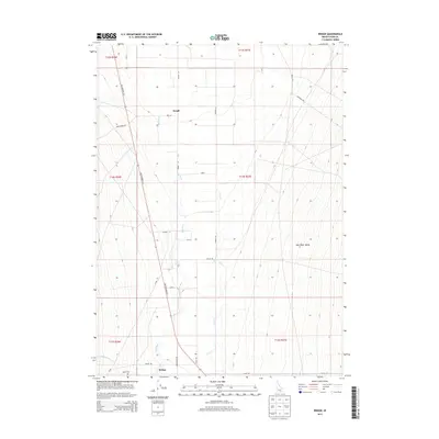
2013 Map of Bridge
USGS Topo · Published 2013About this map
Raft River Valley agriculture and transit dominate this southern Idaho landscape, where the Raft River meanders northward through a network of section lines and irrigation channels. The settlement of Bridge anchors the southern portion of the sheet near the junction of Olson Rd and Bridge Naf Rd, while the northern area is marked by Keogh. Transport history is legible through the path of Old Highway 30 S, which parallels the river and intersects numerous local routes like Kane Spring Rd and Kelley Rd. The reliance on local water sources is evident in the drainage patterns of Clear Cr and Cottonwood Cr. Genealogists and local historians will find the Olson Cem near the river’s edge, a quiet landmark amidst the expansive grid of Cassia County farmland.
Find a feature on this map
25 named features on this map. Tap any name to fly to it.
Don’t see what you’re looking for? This feature index may not catch every label — zoom into the map to look around manually.
Map Details
Editions of this 2013 Bridge Map
This is the sole edition of this map. No revisions or reprints were ever made.
Other maps of this area

1954 · Pocatello
USGS Topo · 1:250,000

1958 · Pocatello
USGS Topo · 1:250,000

1958 · Sublett
USGS Topo · 1:62,500

1959 · Strevell
USGS Topo · 1:62,500

1968 · Malta
USGS Topo · 1:24,000

1968 · Kane Canyon
USGS Topo · 1:24,000

1968 · Nibbs Creek
USGS Topo · 1:24,000

1968 · Naf
USGS Topo · 1:24,000

1968 · Chokecherry Canyon
USGS Topo · 1:24,000

1968 · Bridge
USGS Topo · 1:24,000