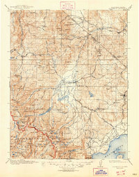
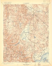
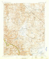
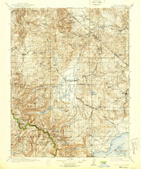
1911 Map of Bridgeport
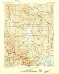
USGS Topo · Published 1947About this map
Bridgeport serves as the central hub of this eastern Sierra landscape, surveyed early in the twentieth century. The map captures a high-altitude world of mineral extraction and frontier transit, anchored by the gold mining district of Bodie and the Masonic (Pittsburg Liberty Mine) to the northeast. The rugged topography is defined by the Sweetwater Mountains and the sawtooth peaks of Yosemite National Park, which dominates the southwestern corner of the sheet. Between these ranges, the East Walker River and Robinson Creek feed a complex system of alpine lakes, including the distinctive Twin Lakes and the northern shores of Mono Lake.
Find a feature on this map
160 named features on this map. Tap any name to fly to it.
Don’t see what you’re looking for? This feature index may not catch every label — zoom into the map to look around manually.
Map Details
Editions of this 1911 Bridgeport Map
7 editions found

Other maps of this area

1889 · Markleeville
USGS Topo · 1:125,000

1891 · Markleeville
USGS Topo · 1:125,000

1891 · Wellington
USGS Topo · 1:125,000

1893 · Markleeville
USGS Topo · 1:125,000

1893 · Wellington
USGS Topo · 1:125,000

1896 · Dardanelles
USGS Topo · 1:125,000

1897 · Yosemite
USGS Topo · 1:125,000

1898 · Dardanelles
USGS Topo · 1:125,000

1900 · Yosemite
USGS Topo · 1:125,000

1901 · Mt. Lyell
USGS Topo · 1:125,000