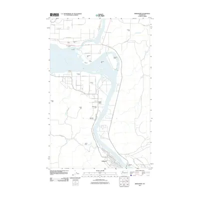
2011 Map of Bridgeport
USGS Topo · Published 2011About this map
The Columbia River dominates the geography of this quadrangle as it flows south toward the modern town of Bridgeport, while the Okanogan River joins it from the north. This area preserves layers of Pacific Northwest history, from the site of Fort Okanogan and the nearby Indian Cemetery to the older riverside settlement of Old Port Columbia. The landscape is defined by its bars and points, including Buenna Bar, Cassimer Bar, and Rattlesnake Point, which speak to the river's influence on local navigation and land use. Inland, the plateau character is visible at Snider Flat and under the shadow of Timber Peak. Modern infrastructure, such as Anderson Field and the Bridgeport Bridge, appears alongside community landmarks like the Bridgeport Grange, showing the evolution of this agricultural and transit hub just east of the Okanogan River confluence.
Find a feature on this map
50 named features on this map. Tap any name to fly to it.
Don’t see what you’re looking for? This feature index may not catch every label — zoom into the map to look around manually.
Map Details
Editions of this 2011 Bridgeport Map
This is the sole edition of this map. No revisions or reprints were ever made.
Other maps of this area

1905 · Okanogan
USGS Topo · 1:125,000

1953 · Ritzville
USGS Topo · 1:250,000

1954 · Okanogan
USGS Topo · 1:250,000

1957 · Bridgeport
USGS Topo · 1:62,500

1957 · Brewster
USGS Topo · 1:62,500

1958 · Okanogan
USGS Topo · 1:250,000

1959 · Ritzville
USGS Topo · 1:250,000

1965 · Ritzville
USGS Topo · 1:250,000

1968 · Chief Joseph Dam
USGS Topo · 1:24,000

1968 · Wells Dam
USGS Topo · 1:24,000