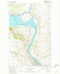
1980 Map of Bridgeport
USGS Topo · Published 1981About this map
Columbia River waters dominate this 1980s landscape, marking the boundary between Douglas and Okanogan counties. The town of Bridgeport serves as a hub of activity at the southern end of the sheet, featuring a Grain Elevator, Athletic Field, and proximity to Chief Joseph State Park. The river valley is a complex of historical sites and conservation areas, including the former locations of Old Port Columbia and Fort Okanogan.
Find a feature on this map
48 named features on this map. Tap any name to fly to it.
Don’t see what you’re looking for? This feature index may not catch every label — zoom into the map to look around manually.
Map Details
Editions of this 1980 Bridgeport Map
This is the sole edition of this map. No revisions or reprints were ever made.
Other maps of this area

1905 · Okanogan
USGS Topo · 1:125,000

1953 · Ritzville
USGS Topo · 1:250,000

1954 · Okanogan
USGS Topo · 1:250,000

1957 · Bridgeport
USGS Topo · 1:62,500

1957 · Brewster
USGS Topo · 1:62,500

1958 · Okanogan
USGS Topo · 1:250,000

1959 · Ritzville
USGS Topo · 1:250,000

1965 · Ritzville
USGS Topo · 1:250,000

1968 · Chief Joseph Dam
USGS Topo · 1:24,000

1968 · Wells Dam
USGS Topo · 1:24,000