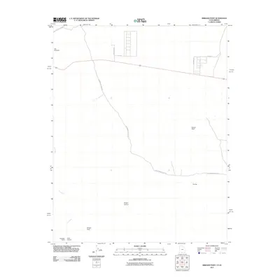
2011 Map of Bridger Point
USGS Topo · Published 2011About this map
The Paria River carves a winding path through this corner of the Colorado Plateau, where the arid landscape is defined by deep incisions like Buckskin Gulch and the vast Paria Canyon. This 2011 survey by the U.S. Geological Survey illustrates a region of dramatic topographic relief, from the prominent heights of Bridger Point and Flat Top down into the depths of Bridger Canyon. Human imprint on the land is represented by a sparse network of thoroughfares, most notably the winding Cottonwood Canyon Rd and the straight alignments of Clark Bench Rd and South Ave near the northern border. This map serves as an essential reference for understanding the hydraulic and geological forces that shaped the The Rimrocks and the drainage patterns of Chitum Wash.
Find a feature on this map
13 named features on this map. Tap any name to fly to it.
Don’t see what you’re looking for? This feature index may not catch every label — zoom into the map to look around manually.
Map Details
Editions of this 2011 Bridger Point Map
This is the sole edition of this map. No revisions or reprints were ever made.
Other maps of this area

1886 · Escalante
USGS Topo · 1:250,000

1886 · Echo Cliffs
USGS Topo · 1:250,000

1891 · Echo Cliffs
USGS Topo · 1:250,000

1953 · Nipple Butte
USGS Topo · 1:62,500

1954 · Lees Ferry NW
USGS Topo · 1:24,000

1954 · Paria Plateau NW
USGS Topo · 1:24,000

1954 · Paria NW
USGS Topo · 1:24,000

1954 · Lees Ferry
USGS Topo · 1:62,500
1954 · Paria Plateau
USGS Topo · 1:62,500
1954 · Paria SW
USGS Topo · 1:24,000