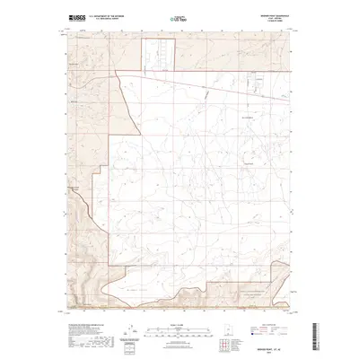
2023 Map of Bridger Point
USGS Topo · Published 2023About this map
Bridger Point and the surrounding canyonlands at the southern edge of Kane County define this landscape along the Utah-Arizona border. The map documents the intricate drainage patterns where Buckskin Gulch and the Paria River converge, carving deep into the plateau near the Paria Canyon-Vermilion Cliffs Wilderness. Significant geological formations including The Rimrocks, Picturesque Windows, and Flat Top are clearly delineated, showing the complex topography of the East Clark Bench.
Find a feature on this map
25 named features on this map. Tap any name to fly to it.
Don’t see what you’re looking for? This feature index may not catch every label — zoom into the map to look around manually.
Map Details
Editions of this 2023 Bridger Point Map
This is the sole edition of this map. No revisions or reprints were ever made.
Other maps of this area

1886 · Escalante
USGS Topo · 1:250,000

1886 · Echo Cliffs
USGS Topo · 1:250,000

1891 · Echo Cliffs
USGS Topo · 1:250,000

1953 · Nipple Butte
USGS Topo · 1:62,500

1954 · Lees Ferry NW
USGS Topo · 1:24,000

1954 · Paria Plateau NW
USGS Topo · 1:24,000

1954 · Paria NW
USGS Topo · 1:24,000

1954 · Lees Ferry
USGS Topo · 1:62,500
1954 · Paria Plateau
USGS Topo · 1:62,500
1954 · Paria SW
USGS Topo · 1:24,000